Table of Contents
- Why Field Survey Data Accuracy Breaks Down on Site
- Alternatives to Manual Field Data Entry That Reduce Human Error
- Offline Field Data Management for Remote Sites and Dead Zones
- Hardware Requirements for Offline Field Work
- Data Security and Encryption During Offline Storage
- Troubleshooting Sync Conflicts and Data Integrity Issues
- Best Practices for Construction Site Reporting
- Frequently Asked Questions
Last Updated: September 12, 2026
Why Field Survey Data Accuracy Breaks Down on Site
Improving field survey data accuracy starts with an uncomfortable truth: most errors are not caused by careless inspectors but by the tools and workflows they are forced to use, and improving field survey data accuracy means fixing those tools first. When a surveyor balances a clipboard on a tailgate in the rain, transcribes coordinates by hand, and re-types notes after a twelve-hour shift, mistakes are a certainty.
This guide from PhotoLog covers where accuracy breaks down, what replaces manual entry, and how to keep field data trustworthy with no signal.
The failure points repeat across nearly every project:
- Transcription errors. Handwritten notes get misread, and numbers get transposed during data entry back at the office.
- Lost context. A photo without a location or timestamp is nearly useless months later during a dispute or audit.
- Delayed capture. Observations recorded hours after the fact lose detail, and details are exactly what quality control depends on.
- Fragmented records. Notes live in one app, photos on a phone, and forms in a binder. Nothing reconciles.
Each is a process problem, not a people problem. Fix the process and accuracy improves.
Alternatives to Manual Field Data Entry That Reduce Human Error
The most effective alternatives to manual field data entry remove transcription entirely: data is captured once, in structured form, at the moment of observation, eliminating the largest category of field errors.
Digital Forms and Structured Capture
Digital forms replace free-text notes with defined fields, dropdowns, and required entries, so an inspector cannot skip a defect type or location field. Data arrives in the office already organized, ready for real-time reporting rather than re-typing.
The trade-off: rigid forms can feel slow when an inspector is documenting something unusual. Build in an open notes field for the exceptions.
Geotagging and Automated Time-Stamping
Geotagging and automated time-stamping attach location and time to every record without manual input. A geotagged photo with an automatic timestamp is self-verifying evidence of where and when the observation was made, which matters for compliance, change orders, and dispute resolution.
PhotoLog was built around this principle: it turns an Android device into a field documentation tool that automatically geotags and time-stamps every image, then lets inspectors add typed or dictated notes so each photo is searchable by session key or date.
Test your geotagging accuracy before you rely on it for official reports. Capture a few known reference points, then verify the coordinates against a map before you trust the workflow on a live survey.
Offline Field Data Management for Remote Sites and Dead Zones
Offline field data management means capturing, storing, and structuring survey records on the device itself, with no dependency on a live connection. It is the most important capability for remote site work, because dead zones are the normal condition on rural infrastructure, underground work, and most industrial construction sites. Integrating these robust offline workflows becomes even more critical when deploying advanced drone survey techniques to ensure that high-resolution aerial data remains secure and accessible regardless of cellular availability.
A workable offline workflow has four requirements:
- Local-first capture. Every photo, note, and form saves to the device immediately, not to a server that may be unreachable.
- On-device organization. Records must be sortable and searchable without a connection, using session keys, dates, or project tags.
- Deferred sync. Data uploads automatically when a connection returns, without the inspector manually triggering anything.
- Conflict handling. When two devices edit the same record, the system needs a defined rule for which version wins.
Get these four right and connectivity stops being a risk to data integrity. Get them wrong and you will eventually lose a day of survey work to a failed upload.
Hardware Requirements for Offline Field Work
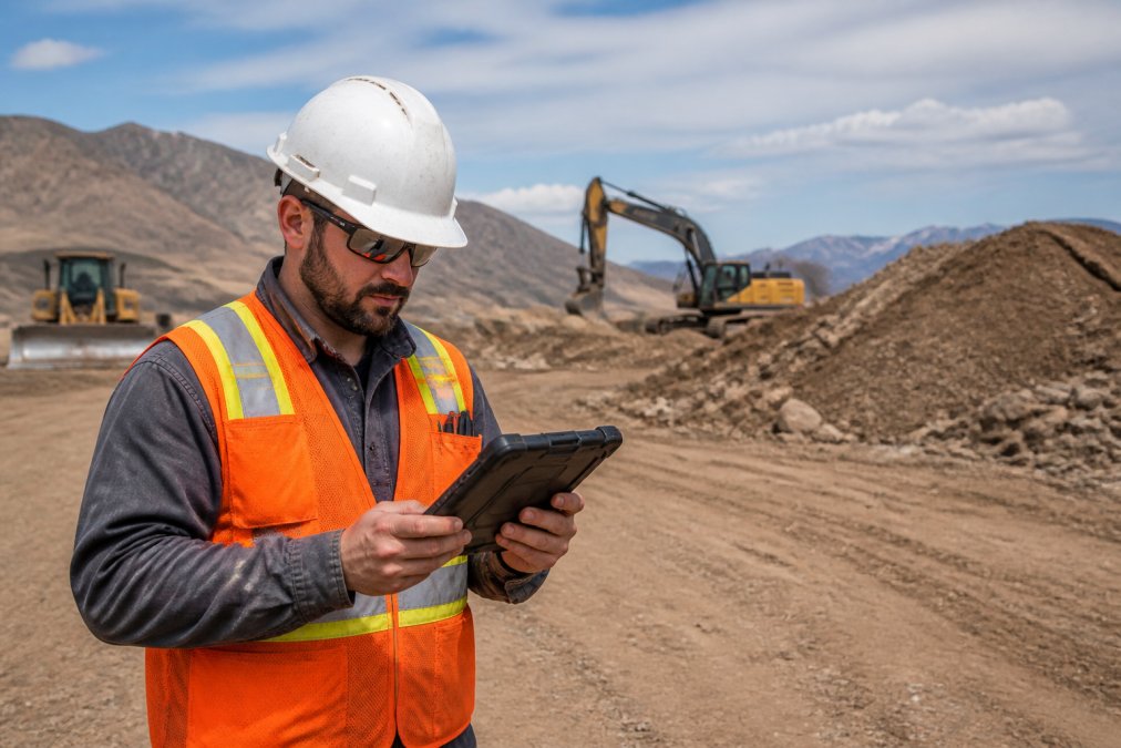
Most guides treat offline capability as a software feature, but the device decides whether the workflow survives a real site. A consumer phone will fail long before the app does, usually silently: a dead battery at hour nine, a GPS lock that never resolves under a steel canopy, or a full storage partition that drops the last forty photos of the day.
Device class and environmental sealing
Match the device to the site, not the office. Three classes cover most field survey work:
- Ruggedized handhelds and tablets. Look for an IP rating that states dust and water ingress protection (IP65 and above is the common threshold for washdown and rain exposure) plus a drop rating against concrete. These are heavier and cost more, but they survive being set down on gravel.
- Consumer tablets in a sealed case. Cheaper and lighter, and adequate for dry, temperate sites. The case is doing the ruggedization work, so a cracked screen or a failed port seal is a real risk on a multi-season project.
- Phones as a secondary capture tool. Fine for quick geotagged photos, poor for sustained form entry, and the weakest link for battery and storage.
Battery math for a full shift
Do not plan around a rated battery figure; plan around the actual drain from GPS, screen-on time, and camera use. Continuous GPS logging plus periodic photo capture consumes a battery far faster than messaging, and cold weather compounds this, lithium-ion cells lose usable capacity as temperatures drop, so a device that lasts a summer shift may not last a winter one (nrc.canada.ca). Carry a power bank as standard kit, and treat a spare battery or vehicle charger as part of the workflow.
Storage headroom and large files
Storage is the requirement teams underestimate. Hundreds of site photos per visit, plus BIM models and CAD drawings, consume space quickly, and a full partition is a data-loss event. Two rules help:
- Prefer expandable storage. A microSD slot lets you swap in capacity without replacing the device, and lets you keep a physical copy of the day’s capture separate from the device’s internal memory.
- Budget for the largest files you handle. If your team opens BIM or CAD files on site, size the device around those files, not around photos alone.
GPS accuracy in the environments you actually work in
Positioning performance varies by environment: open sky is easy, but a tree canopy, deep trench, building interior, or steel structure will degrade or block a fix. Two habits improve results:
- Wait for a stable fix before capturing. A record taken before the receiver has settled can carry a coordinate that is off by a meaningful margin, and that error is invisible in the file.
- Test in the real environment. Verify accuracy against known reference points on the actual site, not in a parking lot, before you rely on the workflow for official reports.
Screen visibility and input
A screen you cannot read in direct sun is one your team will not use, and glare is the most common reason field staff revert to paper. Check brightness and anti-reflective treatment outdoors. Gloves and cold hands make small on-screen keyboards unreliable, so dictation and large touch targets matter more than resolution.
The practical rule: buy for the worst site you work on, not the average one. The device that survives the worst day is the device that keeps your data intact.
Data Security and Encryption During Offline Storage
Data security during offline storage is the gap most field apps ignore. Records on a device with no connection sit outside your network controls, so if that device is lost or stolen, the survey documentation goes with it.
Minimum protections to insist on:
- Encryption at rest. Stored photos and notes should be encrypted on the device, not just in transit.
- Device-level authentication. Biometric or PIN lock before the app opens.
- Access control. You should be able to limit who can view or export sensitive site documentation.
- Selective GPS. A privacy control that lets you switch geotagging off for records that should not carry a location.
PhotoLog includes switchable GPS so teams can control when location data is attached, which matters for privacy-sensitive audits. For regulated environmental work, confirm your app’s handling against the Office of the Privacy Commissioner of Canada guidance on privacy in the workplace before deploying it across a team.
A lost or stolen device with unencrypted survey data can trigger a reportable privacy breach. Confirm encryption is on before field deployment, not after.
Troubleshooting Sync Conflicts and Data Integrity Issues
Sync conflicts happen when the same record is edited in more than one place before devices reconnect. This is where data integrity is won or lost. With multiple inspectors and intermittent connectivity, conflicts are inevitable, the goal is to make them visible, predictable, and resolvable.
Why conflicts happen
A conflict requires three conditions: the same record, more than one editor, and a connectivity gap long enough for both edits to be made offline. On a remote site, all three are normal, two inspectors may open the same session record, a supervisor may annotate an already-edited photo, or a form template may be updated while a device holds the old version.
How versioning resolves a conflict
Most offline-first systems use one of a few resolution models, know which one your app uses before deploying it across a team:
- Last-write-wins. The most recent edit by timestamp overwrites the earlier one. Simple and fast, but it silently discards the earlier edit, which is dangerous for survey notes where both edits may carry real information.
- Version history with manual merge. Both edits are preserved and flagged for a human to reconcile. Safer for compliance work, but it requires someone to actually review the flagged records.
- Field-level merge. The system merges non-overlapping changes automatically and only flags true collisions on the same field. This is the most usable model when it is available, because it resolves most conflicts without human intervention.
Whichever model applies, the discipline is the same: know the rule and make sure the team knows it too. A conflict nobody understands gets resolved by guessing.
A troubleshooting sequence that works
When records look wrong after a sync, work through the causes in order:
| Problem | Likely Cause | Fix |
|---|---|---|
| Duplicate records after sync | Same session captured on two devices | Assign one device per session key |
| Overwritten notes | Two edits to one record offline | Use version control with timestamps and review flagged records |
| Missing photos after upload | Upload interrupted mid-transfer | Verify record count after each sync |
| Wrong coordinates | GPS not locked at capture | Wait for a location fix before shooting |
| Stale forms | Old template cached on device | Push form updates before site visits |
| Partial records | Sync started before capture finished | Confirm the session is closed before syncing |
Preventing conflicts before they happen
The cheapest fix is structural: assign one session key per device per visit so two devices never write to the same record, close the session before syncing, push form and template updates before devices leave for site, and keep a second copy of the day’s capture until the sync is confirmed.
Verifying integrity after sync
Verification separates a workflow that holds up from one that quietly degrades. Before leaving site, the inspector confirms the record count matches the photo count; after sync, someone confirms the uploaded count matches the captured count. A mismatch is a signal to investigate, not to move on.
A sync that reports success is not the same as a sync that transferred everything. Always verify counts on both sides before treating a session as closed.
Best Practices for Construction Site Reporting
Best practices for construction site reporting come down to capturing complete records at the source. Reports assembled from memory days later are unreliable. Reports assembled from geotagged, time-stamped, annotated records are evidence.
A workflow that holds up:
- Open a session key for each site visit before capturing anything.
- Photograph systematically, working zone by zone rather than randomly.
- Annotate immediately, using dictation when hands are full.
- Capture safety logs and compliance forms in the same session as the visual record.
- Verify counts before leaving site.
- Export a formatted report rather than assembling one manually.
PhotoLog supports this end to end: automatic geotagging and time-stamping, typed or dictated notes, instant searchability by key or date, and exportable ZIP files with formatted Field Reports. For teams documenting hundreds of photos per visit, that turns report generation from an evening’s work into a single export. You can review the CSA Group standards for construction documentation to align your records with recognized practice.
The record you can search by date, key, or location is the record that wins a dispute. Manual notes rarely survive that test.
Field survey accuracy is not a matter of inspector diligence but of removing the steps where errors enter. Manual transcription, missing timestamps, and unverifiable locations undermine even the most careful survey team.
PhotoLog addresses each of these directly, with automatic GPS geotagging, automatic date and time stamping, typed and dictated notes, instant searchability by key or date, and exportable ZIP files with formatted Field Reports. Download PhotoLog free and give your field team a documentation workflow that holds up in a dead zone.
Frequently Asked Questions
How can digital tools reduce human error in field surveys?
Digital tools cut error at the point of capture. Geotagging records exact coordinates automatically, so nobody transcribes a location wrong. Time-stamping locks in when the observation was made. Structured digital forms replace free-text notes that get misread later. Together these steps remove the manual transcription layer where most mistakes happen, which directly supports improving field survey data accuracy across every site visit.
What are the best practices for maintaining data integrity during site inspections?
Capture once, in the field, with location and time attached. Use version control on drawings so the crew is marking up the current revision, not a superseded sheet. Sync as soon as you hit a reliable connection, and check for conflicts before they compound. Keep a consistent naming or keying system so photos and notes map to the right asset or location. These habits keep your documentation audit-ready and reduce rework.
Why is geotagging critical for field survey accuracy?
Geotagging ties every photo and observation to a precise location, which matters most for environmental surveys and compliance work where coordinates must hold up in official reports. It also removes the guesswork of matching a photo to a spot on a large site. With switchable GPS you can turn location off where privacy matters and back on where accuracy is required, giving you control without losing the audit trail.
How do offline-first mobile apps improve data reliability?
Offline-first apps let you capture observations, photos, and notes without a signal, then sync when connectivity returns. That means a dead zone on a remote job site does not stop the survey or force you to re-enter data later from memory. The record is created at the source, in the moment, with its location and timestamp intact, which is the foundation of reliable field data.