Table of Contents
- Why Construction Site Photo Management Apps Matter
- Quick Comparison: Key Features and Capabilities
- PhotoLog: Automatic Geotagging and Field Documentation
- Construction Site Photo Documentation Best Practices
- How to Capture Precise GPS Coordinates for Construction Photos
- Offline Access and Data Privacy for Site Documentation
- Choosing the Right Photo App for Your Team
- Conclusion
Last Updated: August 20, 2026
Why Construction Site Photo Management Apps Matter
Construction teams waste hours organizing photos from jobsite documentation. A field inspector snaps 200 images across multiple projects, then spends days sorting through folders to find the one photo showing a specific defect. By the time the image gets into a report, context is lost. The timestamp is missing. Nobody knows exactly where the photo was taken.
This is where construction site photo apps transform the workflow. Instead of chaos, you get instant searchability by date, location, or custom tags. Every photo carries automatic GPS coordinates, timestamps, and metadata. Field-to-office communication becomes seamless because inspectors can annotate images with voice notes or typed observations in real time, then export formatted reports that clients actually want to read.
PhotoLog exemplifies this shift. The app converts your Android device into a professional-grade field documentation tool by automating the parts that slow teams down: geotagging, time-stamping, and session organization. Inspectors no longer manage photo libraries manually. They capture images, add notes, and the app handles the rest.
The real value emerges when you need to prove what happened on a jobsite. Environmental consultants conducting field surveys need precise location and time-stamped evidence for compliance. Home inspectors conducting property audits require offline access so spotty cell service doesn’t kill productivity. Project supervisors at engineering firms need visual data that converts directly into professional field reports. Infrastructure managers tracking equipment maintenance across multiple sites need searchable imagery that links back to specific assets.
Construction site photo management apps aren’t luxury tools, they’re operational necessities for teams that can’t afford to lose documentation or spend hours reconstructing what happened where.

Quick Comparison: Key Features and Capabilities
The best construction site photo apps share core functionality: automatic geotagging, offline access, searchability, and report generation. But they differ significantly in how they handle team collaboration, cloud synchronization, and integration with project management tools.
| Feature | PhotoLog | Key Consideration |
|---|---|---|
| Automatic GPS geotagging | Yes | Critical for compliance and location verification |
| Typed and dictated notes | Yes | Annotations speed up field reporting |
| Instant searchability | By key or date | Faster than manual folder browsing |
| Offline access | Yes | Essential for remote jobsites with poor connectivity |
| Formatted field reports | Exportable ZIP files | Professional output ready for clients |
| Time and date stamping | Automatic | Audit trail for every image captured |
| Privacy controls | Switchable GPS | Teams control what location data is shared |
| Session-based organization | Yes | Groups related photos by event or project |
The table above shows that PhotoLog covers the essential bases. But the decision between apps often comes down to team size, budget, and integration requirements. A solo inspector needs different capabilities than a 15-person crew managing multiple concurrent projects.
PhotoLog: Automatic Geotagging and Field Documentation
PhotoLog stands out because it automates the tedious parts of jobsite documentation without forcing users into rigid workflows. The automatic GPS geotagging means every photo carries location data, no manual entry, no guessing. For environmental consultants and home inspectors, this is non-negotiable. Precise GPS coordinates prove exactly where evidence was collected, which matters for regulatory compliance and client credibility.
The app’s session-based organization simplifies what would otherwise be chaos. Instead of dumping 300 photos into a generic camera roll, inspectors create a session (e.g., "Building A, Foundation Inspection") and all photos from that session are grouped together. Typed or dictated notes attach directly to individual images. Later, when you need to find the photo showing the crack in the concrete, you search by session key or date rather than scrolling through hundreds of thumbnails.
What makes this practical: the formatted field reports. Most apps give you a folder of photos and expect you to assemble reports yourself. PhotoLog exports a ZIP file containing organized images and a structured field report ready to send to clients. For project supervisors who need professional documentation, this saves hours of manual assembly.
The offline access feature matters more than it initially appears. Construction sites, remote surveys, and infrastructure inspections frequently happen in areas with spotty or no cell service. PhotoLog works completely offline, photos are captured, annotated, and organized locally. When you return to an area with connectivity, data syncs automatically. You don’t lose a single image or note.
One honest limitation: PhotoLog is Android-only. If your team uses iPhones, you need a different solution. But for Android-based teams, the automatic geotagging combined with instant searchability and professional report generation covers the primary needs of field documentation.
Construction Site Photo Documentation Best Practices
Effective jobsite documentation goes beyond just taking photos. The best teams treat photo capture as part of their quality control and punch list management process, not an afterthought.
Start by establishing a naming convention or session structure before fieldwork begins. If you’re documenting multiple areas of a building, create separate sessions for each zone. This prevents the common mistake of mixing photos from different inspections into one chaotic folder. When you need to find all photos from the basement electrical work, a properly organized session lets you pull them in seconds rather than scrolling through hundreds of images.
Capture photos from multiple angles whenever possible. A single shot of a defect tells part of the story; photos from different perspectives provide context. Show the defect, the surrounding area, and the relationship to other building elements. This visual evidence approach matters most when disputes arise or when you’re creating as-built documentation.
Timestamp and location data should be non-negotiable. These metadata elements provide the audit trail that makes photos legally defensible. If a photo lacks timestamp or GPS coordinates, its evidentiary value drops significantly. Apps that automate this, like PhotoLog, remove the human error that comes from manual entry.
Use annotations strategically. A quick voice note explaining what the photo shows saves time later. Instead of "crack in concrete," record: "Hairline crack in basement floor, approximately 1.8 metres from northeast corner, appears to follow existing settlement pattern." This level of detail in the field prevents confusion when you’re assembling reports weeks later.
Export and back up your photos regularly. Cloud synchronization is convenient, but local backups protect against data loss. Many teams export photos to external drives or cloud storage as a secondary safety net. For sensitive projects or compliance-heavy documentation, redundant backups are standard practice.
How to Capture Precise GPS Coordinates for Construction Photos
GPS accuracy matters when documentation is used for compliance, environmental surveys, or infrastructure asset tracking. A photo tagged with imprecise coordinates can create legal ambiguity or fail regulatory requirements.
Most modern Android devices include GPS chips capable of accuracy within 5-10 meters under good conditions. Open sky improves accuracy; dense urban environments or areas surrounded by tall buildings degrade it. Construction sites with partial structures can be problematic because GPS signals bounce off steel and concrete.
To maximize GPS accuracy, let your device acquire a satellite fix before taking photos. When you first open PhotoLog on a jobsite, wait 30-60 seconds for the GPS to stabilize. You’ll see the coordinate data update as the device locks onto more satellites. Once coordinates stop changing, you’re ready to photograph.
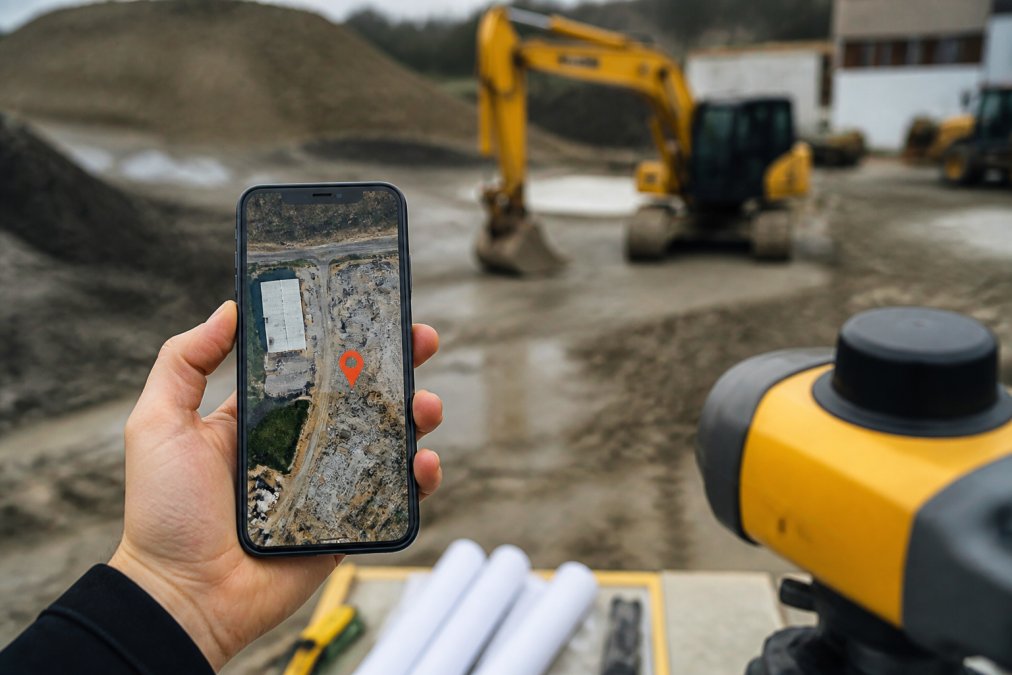
For environmental surveys or compliance documentation where coordinate precision is critical, verify your GPS data. Many apps allow you to view the exact coordinates captured with each photo. Cross-reference those coordinates with your project map or survey data to confirm they match the expected location. If a coordinate seems off, retake the photo in a different spot with better sky visibility.
Some teams use external GPS units for surveys that demand extreme precision. These specialized devices achieve sub-meter accuracy, but they’re overkill for most construction documentation. Standard smartphone GPS, when used correctly, provides sufficient accuracy for jobsite photo documentation, quality control, and punch list management.
Avoid taking photos inside buildings where GPS signals are blocked. If you must document interior spaces, take a photo of your GPS coordinates on the phone screen, then photograph the interior area. This creates a record linking the interior photo to a specific location, even though the phone’s GPS can’t lock inside.
Offline Access and Data Privacy for Site Documentation
Field teams need offline functionality because construction sites, remote surveys, and infrastructure inspections often lack reliable connectivity. An app that requires constant internet connection becomes useless on spotty networks.
PhotoLog operates completely offline. Photos are captured, annotated, and organized on the device without requiring a connection. When you return to an area with cell service, data syncs automatically to your backup or cloud storage. This approach means inspectors never lose work due to connectivity issues.
Data privacy becomes increasingly important as teams digitize sensitive site documentation. Photos of building defects, environmental issues, or infrastructure problems are often confidential. Clients expect that photos won’t be exposed or shared without permission.
PhotoLog addresses this with switchable GPS. Teams can control whether location data is included in exported reports. For some projects, precise GPS coordinates are essential. For others, you might want to exclude location data for privacy reasons. Having that control prevents accidental disclosure of sensitive site locations.
When exporting reports or sharing photos, understand what metadata travels with the image. Most apps, including PhotoLog, allow you to export ZIP files containing organized images and reports. Before sharing, confirm that sensitive data (GPS coordinates, timestamps, or internal notes) isn’t included unless the recipient needs it.
For teams handling regulated documentation (environmental surveys, compliance inspections), data retention policies matter. Understand how long the app retains photos and whether it offers permanent deletion options. Some apps keep copies in cloud storage indefinitely; others delete local copies after a set period. For compliance-heavy work, this distinction is significant.
Choosing the Right Photo App for Your Team
The best construction site photo app depends on your team size, project complexity, and integration needs. A solo home inspector has different requirements than a 15-person crew managing multiple concurrent jobsites.
Consider team size first. If you’re a solo operator or small team (2-4 people), you need simplicity and offline reliability. PhotoLog fits this profile well, it’s designed for individual inspectors and small crews who need professional documentation without complexity. The automatic geotagging and searchability eliminate manual work, and the offline access means you’re never stuck without the ability to document.
For larger teams managing multiple projects simultaneously, integration with project management tools becomes important. Does the app connect to your existing workflow? Can photos automatically sync to a central project database? Can team members access shared documentation? These questions matter more as team size grows.
Budget is real. Some apps charge per user, others per project, and some use flat-rate models. For a 12-person inspection crew, per-user pricing can add up quickly. Understand the pricing structure before committing to a platform.
Consider where your team works. If you’re primarily in areas with good cellular coverage, cloud-based apps with automatic syncing work fine. If you frequently work in remote areas with spotty connectivity, offline-first apps like PhotoLog become essential. An app that requires constant internet becomes a liability on jobsites with poor signal.
Ask whether the app generates professional reports. Some apps give you a folder of photos and expect you to assemble reports yourself. Others, like PhotoLog, export formatted field reports ready to send to clients. This distinction saves hours of manual work if you’re generating multiple reports per week.
Finally, test the app on your actual devices and jobsites before rolling it out to your entire team. A tool that works perfectly in an office might perform poorly in harsh sunlight or with gloved hands. Real-world testing prevents costly mistakes and retraining.
Conclusion
Construction site photo management apps solve a real problem: turning chaotic visual documentation into searchable, organized, professional records. The best apps automate the tedious parts, geotagging, time-stamping, session organization, so your team focuses on capturing quality images rather than managing files.
PhotoLog delivers this with automatic GPS geotagging, offline access, instant searchability by key or date, and formatted field reports ready for clients. For field inspectors, environmental consultants, and project supervisors who need reliable jobsite documentation, PhotoLog transforms an Android device into a professional-grade field documentation tool. Download PhotoLog free and see how automatic geotagging and real-time annotations simplify your documentation workflow.
Frequently Asked Questions
What features should I look for in a construction site photo management app?
Prioritize automatic geotagging, timestamped metadata, offline access, and searchability by date or custom tags. Field-to-office communication features matter if your team needs real-time updates. Verify the app generates exportable reports suitable for client presentations and audit trails. GPS accuracy is critical for compliance-heavy work like environmental surveys or infrastructure inspections. Check whether the app works on Android, iOS, or both based on your team's devices.
How do you organize construction site photos effectively?
Use session-based organization with custom keys or project identifiers. Tag photos with descriptive notes, either typed or voice-recorded, immediately after capture. use automatic timestamping and geotagging to create searchable metadata. Group images by jobsite, inspection type, or phase of work. Export organized batches into formatted field reports rather than storing loose image folders. This approach cuts time spent hunting for specific photos and simplifies handoff to office teams.
Why is geotagging important for construction documentation?
GPS coordinates provide precise location evidence for as-built documentation, quality control punch lists, and compliance verification. Geotagged photos prove work was completed at the correct site and location, which is essential for insurance claims, legal disputes, and regulatory audits. For environmental surveys and infrastructure maintenance, accurate coordinates ensure data meets compliance standards. Geotagging also helps teams quickly locate problem areas during site inspections without relying on memory or written descriptions.
Can construction photo apps help with legal liability and audits?
Yes. Timestamped, geotagged photos create an auditable record of site conditions, completed work, and defects at specific moments. This visual evidence protects contractors and inspectors by documenting what was observed and when. Exportable reports with metadata trails satisfy regulatory requirements for environmental consultants and infrastructure managers. Automated audit trails show who captured each photo and when it was accessed, reducing disputes over documentation authenticity.
This article was written using GrandRanker