Table of Contents
- Why Generic Storage Falls Short for Field Documentation
- Cloud Based Photo Reporting Tools: Feature Comparison
- PhotoLog: Purpose-Built for Field Documentation
- How to Capture Precise GPS Coordinates on Site
- Automated Field Report Generation Saves Hours
- Choosing Construction Site Photo Documentation Software
- Security, Privacy, and Compliance in the Cloud
- Which Tool Should You Pick?
- Frequently Asked Questions
Last Updated: September 4, 2026
Cloud based photo reporting tools have transformed field documentation, but most teams use the wrong solution. Generic storage platforms treat photos as files, not as evidence with context, location, and time. This guide separates a reporting tool from a folder in the cloud.
The core distinction is structure. A true cloud based photo reporting platform captures metadata automatically, organizes images by event or project, and generates formatted reports. Generic tools give you storage; purpose-built tools give you a workflow.
Why Generic Storage Falls Short for Field Documentation
Most teams default to existing cloud storage. It works until you must answer: which photos belong to site visit three on the Hamilton project?
The problem is that generic platforms store images without context. A photo of a foundation crack is just an image file until you know when it was taken, where it was taken, and what it relates to. Guidance on construction documentation best practices emphasizes that accurate visual records are essential for quality assurance and compliance reporting, yet most storage tools capture none of this context automatically.
Generic storage also misses the reporting layer. You must export images, open a document editor, and build a report manually, a workflow that eats hours weekly and introduces errors.
A photo without a verifiable timestamp and location is nearly useless in a dispute or compliance audit. If your storage tool doesn’t capture this metadata automatically, you’re building a documentation trail with gaps in it.
Cloud Based Photo Reporting Tools: Feature Comparison
Not all tools handle field documentation the same way. The table below compares the main options across the criteria that matter for site-based teams.
| Tool | Platform | Key Strength | Best For |
|---|---|---|---|
| PhotoLog | Android | Automatic geotagging, timestamps, and built-in Field Report generation | Inspectors needing searchable, report-ready evidence |
| PhotoReport | iOS only | Automated site photo report generation | Construction site managers on iPhone/iPad |
| Blitzz | Cross-platform | Live remote visual support | Field service technicians needing real-time help |
| Adobe Creative Cloud | Cross-platform | Professional editing and asset management | Photographers and creative teams |
| Backblaze | Cross-platform | Unlimited backup capacity | Large-scale photo backup without reporting needs |
| Google Photos | Cross-platform | AI search and organization | General users needing quick photo storage |
| Dropbox | Cross-platform | File sync and team sharing | Collaborative file management |
| Nextcloud Photos | Self-hosted | Full data control | Organizations with strict data sovereignty rules |
What to Look For in a Reporting Tool
Field reporting software must do four things: capture metadata automatically, organize photos by project or event, generate reports directly from images, and sync to the cloud while working offline.
Research on mobile data capture in field work highlights that offline capability and reliable synchronization are critical for teams operating across multiple remote sites. If a tool fails on any of these four, you’ll compensate with manual workarounds.
PhotoLog: Purpose-Built for Field Documentation
Our top pick for field teams is PhotoLog, and it’s not a close call for Android users. PhotoLog transforms your Android camera into a professional-grade field documentation tool. Every image is automatically geotagged and stamped with the date and time, then organized under session-based keys you define for each project or site visit.
What makes PhotoLog different is the reporting layer built directly into the workflow. You don’t export photos and start a separate document. The built-in Field Report generates formatted output you can share as a ZIP file through any phone app. For a supervisor reviewing 200 photos from a site inspection, that means the report arrives ready for review, not as a folder of images to sort.
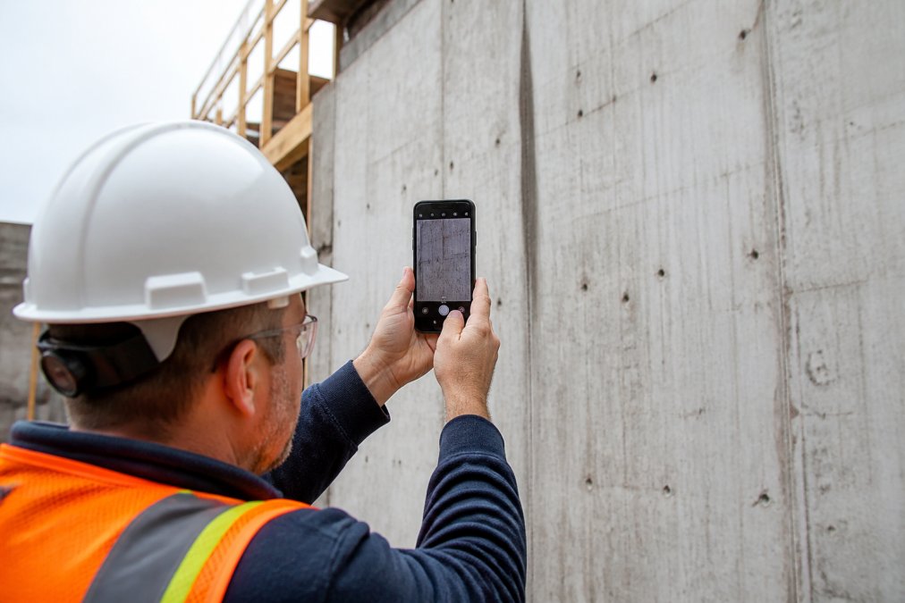
Automatic Geotagging and Timestamps
Manual data entry fails in the field. PhotoLog removes that step by embedding GPS location and time data into every image at capture.
Privacy control is built in: GPS tagging can be switched off for sensitive interior work. Every photo remains searchable by event key or date, and voice or typed annotations add context without slowing capture.
How to Capture Precise GPS Coordinates on Site
Precise GPS coordinates are the difference between a photo that proves a location and one that merely shows it. For environmental surveys and compliance reporting, this accuracy is non-negotiable.
Confirm your device has a clear view of the sky; GPS accuracy degrades near tall structures, under tree cover, or inside buildings. On Android, verify location services are set to high accuracy mode, which uses GPS, Wi-Fi, and mobile networks.
PhotoLog embeds coordinates automatically. To verify accuracy, cross-check the position against a known reference point on site, such as a survey marker; coordinates should match within a few metres.
Wait two to three seconds after opening the camera before taking the first photo. GPS receivers need a moment to lock onto satellites, and photos taken immediately after app launch may record a stale location from the last known position.
Automated Field Report Generation Saves Hours
Manual report writing is the biggest time drain in field documentation. Inspectors return to the office, download photos, rename files, insert them into a document, and type descriptions, a single report can consume an afternoon.
Automated field report generation compresses that process to minutes. The software organizes photos by event, applies metadata, and assembles a formatted report.
The practical impact shows up in the volume of work a single inspector can handle. When documentation takes minutes instead of hours, more site visits fit into the week, and reports reach clients and stakeholders faster. Analysis of productivity gains from mobile field reporting notes that digitizing field workflows reduces administrative overhead substantially for inspection-based industries.
Choosing Construction Site Photo Documentation Software
Construction site photo documentation software must handle volume. A typical site visit can produce 200 to 300 photos.
Look for software that assigns photos to projects automatically. On PhotoLog, you define a session key before shooting, and every photo is grouped under it, eliminating post-visit sorting.
Integration with project management systems matters too. The best workflows push photos directly into systems your office team uses, avoiding data re-entry.
Security, Privacy, and Compliance in the Cloud
Generic encryption assurances are table stakes. What separates a defensible platform from a liability is how it handles legal and regulatory obligations.
The Compliance Baseline Most Teams Miss
A photo of a site condition is a business record. If it contains personal information, a license plate, a worker’s face, a residential interior, it triggers obligations under the Personal Information Protection and Electronic Documents Act (PIPEDA). The Office of the Privacy Commissioner of Canada expects organizations to limit collection to what is necessary, to secure it appropriately, and to retain it only as long as needed. PIPEDA compliance guidance for businesses outlines these obligations in detail.
Most cloud storage platforms store photos in data centers outside Canada. For projects governed by procurement rules or data residency clauses, that can disqualify a tool. Verify where data is stored and whether the vendor offers Canadian residency options.
What a Defensible Audit Trail Actually Requires
Beyond encryption at rest and in transit, a tool that holds up in a dispute or a compliance audit must provide:
- Immutable metadata: Timestamps and GPS coordinates that cannot be altered after capture. If an inspector can edit the time or location in post-production, the evidence is contestable.
- Granular role-based access: The ability to restrict who can view, export, or delete photos. A subcontractor on site should not have the same access as the project owner.
- Full audit logging: A record of every login, export, and deletion event. If a photo disappears, you need to know who accessed it last.
- Retention controls: Automated deletion or archival policies that match your contractual obligations. Keeping photos indefinitely increases your exposure if a privacy complaint arises.
Practical Steps for Compliance-Ready Field Capture
Most field teams need a repeatable process, not legal expertise. A common pattern is to disable automatic geotagging for interior or sensitive work, then re-enable it for exterior documentation.
Second, establish a retention schedule before starting a project, whether photos are destroyed 90 days after close or archived for seven years.
If your reporting tool stores data outside Canada and you have not verified the vendor’s sub-processor list, you may be in breach of your own client contracts. Data residency is a contractual issue, not just a technical one.
For teams demonstrating compliance to enterprise clients or agencies, exporting a complete access log alongside your photo report is a differentiator. Most generic platforms cannot produce this.
Which Tool Should You Pick?
The decision matrix below weighs total cost of ownership, including training, manual workarounds, and report assembly.
Decision Matrix by Team Profile
| Team Profile | Recommended Approach | Why | Key Trade-off |
|---|---|---|---|
| Android-based field inspectors (1-10 users) | PhotoLog | Automatic geotagging, offline capture, and built-in Field Report generation eliminate the manual assembly step entirely | Android only; iOS teams need a separate workflow |
| iOS-only construction site managers | PhotoReport | Construction-specific templates reduce formatting time for client-facing reports | No Android support limits device flexibility |
| Field service technicians needing live remote guidance | Blitzz | Real-time visual support reduces repeat visits and speeds up troubleshooting | Pricing is not transparent; reporting depth is secondary to live video |
| Organizations with strict data sovereignty rules | Nextcloud Photos (self-hosted) | Full control over data location and access logs | Requires dedicated IT maintenance; no purpose-built reporting layer |
| Teams defaulting to existing cloud storage | Re-evaluate immediately | Storage platforms lack metadata capture, project organization, and report generation | The cost of manual workarounds far exceeds any storage savings |
Time-to-Value: What Implementation Actually Looks Like
Based on typical deployment patterns, the rollout follows a predictable curve:
- Day 1 – Setup and configuration: An administrator defines session keys for active projects, sets GPS accuracy preferences, and configures export formats. This takes under an hour for a single project.
- Day 2-3 – Field pilot: One or two inspectors capture photos on a live site using the tool. They verify that geotags match known reference points and that the Field Report generates correctly. Most teams identify one or two workflow adjustments during this phase, such as changing session key naming conventions.
- Week 1 – Full team rollout: Once the pilot confirms the workflow, the rest of the field team is trained in a single session. The core capture flow, open app, confirm session key, shoot, annotate, takes about 15 minutes to learn. No formal certification is required.
- Week 2-3 – Office workflow integration: The office team begins receiving Field Reports as ZIP files instead of raw photo folders. This is where the administrative time savings become visible.
Teams typically see a measurable reduction in report assembly time within the first two weeks.
Calculating the ROI of Purpose-Built Reporting
To justify the switch from a generic tool, calculate the time your team currently spends on manual documentation:
Step 1: Estimate current report assembly time.
A typical site inspection produces 200-300 photos. Manually renaming files, inserting them into a document, and writing descriptions takes 1.5 to 3 hours per report for an experienced inspector. Use the lower bound if your team is fast, the upper bound if they are meticulous.
Step 2: Multiply by weekly report volume.
If an inspector produces four reports per week, the manual time cost is 6 to 12 hours weekly. At a fully loaded hourly cost of $45 for a mid-level inspector, that is $270 to $540 per week per inspector.
Step 3: Compare against automated workflow time.
With a purpose-built tool, report assembly drops to 15-30 minutes per site visit because photos are already organized and metadata is embedded. The remaining time is spent reviewing and adding annotations, not sorting files.
Step 4: Calculate the weekly savings.
For the same inspector producing four reports per week, the automated workflow saves 5 to 10 hours weekly. At $45 per hour, that is $225 to $450 per week per inspector, or $11,700 to $23,400 annually. For a team of five inspectors, the annual savings range from $58,500 to $117,000.
The Hidden Cost of Staying with Generic Storage
If you are using a generic cloud folder, add the cost of searching for misplaced photos, re-shooting images lacking location context, and reconciling discrepancies.
The decision is not about which tool has the most features. It is about which tool removes the most manual steps from your specific field-to-office workflow. Run the ROI calculation above with your own numbers before you commit to a platform.
Avoid defaulting to a generic storage platform. If your tool doesn’t capture metadata automatically, organize by project, and generate reports, your team pays with hours of manual work.
Frequently Asked Questions
What is the difference between simple photo storage and reporting software?
Simple photo storage like Google Photos or Dropbox keeps your images safe in the cloud, but it doesn’t structure them for field work. Reporting software automatically adds geotags, timestamps, and notes to each photo. It groups images by project or event, and it generates formatted PDF reports ready to send to clients. This turns a folder of photos into a documented record, saving hours of manual sorting and report writing.
How does geotagging improve the accuracy of site reports?
Geotagging pins each photo to its exact GPS location, which removes guesswork about where an issue was found. When you capture precise GPS coordinates automatically, the report shows the inspector was on site at the right place and time. This strengthens quality assurance and compliance reporting, and it makes it harder for disputes to arise over what was documented and where.
Are cloud-based photo reports legally admissible for insurance claims?
Yes, when the photos include accurate metadata like timestamps and GPS coordinates, they serve as strong evidence. The key is maintaining a clear audit trail. Tools that automatically stamp each image and prevent tampering make the documentation more credible. For critical claims, verify the geotagging accuracy on site before relying on it for official reports, and keep secure online backup of all original files.
What features should I look for in construction site photo documentation software?
Focus on automated labeling, metadata preservation, and offline data capture. Your team works in remote areas, so the app must function without cell service and sync later. Look for automatic geotagging and timestamps, voice or typed notes, and instant search by project key. The tool should generate professional PDF field reports directly, so you don’t spend evenings organizing photos. Check that it handles high volumes without slowing down.
Field documentation is only as valuable as the context attached to it. A photo without a timestamp, location, and project association is just an image. PhotoLog solves this by transforming your Android device into a complete field documentation system, with automatic GPS geotagging, date and time stamping, instant searchability by key or date, and exportable ZIP files containing formatted Field Reports. Get started with PhotoLog and turn every site photo into report-ready evidence.
This article was written using GrandRanker