Table of Contents
- What Field Data Collection Actually Involves
- Choosing Mobile Data Collection Software That Works On-Site
- Offline-First Data Synchronization for Remote Areas
- Data Quality Assurance in Fieldwork
- Digital Field Survey Templates That Speed Up Data Capture
- Data Security and Privacy Compliance in Field Operations
- Efficient Field Data Collection Methods: Common Mistakes to Avoid
- Conclusion
Last Updated: August 9, 2026
What Field Data Collection Actually Involves
Field data collection is the systematic process of gathering, recording, and organizing information directly at the source location, outside of a controlled office or laboratory environment. Field personnel face conditions office-based workflows never encounter: unreliable connectivity, extreme temperatures, time pressure, and constant risk of human error under physical stress.
This guide covers the full stack: digital vs. analogue methods, mobile tools, offline sync, data quality, security, and the mistakes that quietly destroy data integrity.
Structured vs. Unstructured Data in the Field
Structured data is information organized into predefined formats: GPS coordinates, timestamps, numeric measurements, dropdown selections, and checkbox responses. Unstructured data covers everything else: voice annotations, free-text notes, photographs, and video clips. Most fieldwork generates both. The most effective digital field survey templates bind structured and unstructured inputs together at the point of capture, so a photo is automatically paired with its metadata rather than manually matched later.
Digital vs. Analogue Collection Methods
Paper-based data entry remains common on Canadian construction and environmental sites, particularly where regulations require physical signatures. Paper is resilient but creates a data synchronization bottleneck the moment the crew returns to the office. Digital methods enable real-time data transmission, automatic metadata attachment, and direct integration with cloud-based storage.
| Method | Best For | Key Limitation | Data Integrity Risk |
|---|---|---|---|
| Paper forms | Regulated sign-off workflows | Manual transcription errors | High (re-entry) |
| Mobile apps (online) | Urban/suburban sites | Connectivity dependent | Medium |
| Mobile apps (offline-first) | Remote or rural sites | Sync conflict management | Low |
| Dedicated GPS devices | Precision geospatial data | Single-purpose hardware | Low |
| Wearables/sensors | Continuous monitoring | High setup complexity | Low-Medium |
For most Canadian field operations, a mobile-first digital approach with offline capability is the practical standard.
Choosing Mobile Data Collection Software That Works On-Site
The biggest mistake teams make when selecting mobile data collection software is evaluating it in a conference room with full Wi-Fi. The user interface that looks clean on a desk becomes a liability when you’re wearing gloves, standing in direct sunlight, or managing 200 photos across three concurrent job sites.
Effective mobile data collection software must handle four things well: fast data capture, automatic metadata attachment, offline operation, and structured export.

For field documentation, the most practical tools integrate photo capture with automatic geotagging and timestamping at the moment of capture. PhotoLog’s approach differs from generic camera apps: every image is automatically tagged with GPS coordinates, date, and time, and linked to a session-based key so photos from multiple sites never get mixed up.
GPS and Location Tracking Integration
GPS and location tracking integration is non-negotiable for environmental surveys, infrastructure inspections, and any fieldwork where the spatial relationship between data points matters for compliance or reporting.
For most inspection workflows, you need accurate point coordinates attached to each photo or observation. The practical threshold for compliance use in Canada is typically sub-5-metre accuracy under open sky, which standard smartphone GPS delivers reliably. Tall structures, dense forest canopy, and urban canyon effects all degrade location tracking, so verify coordinate accuracy at the start of each session by cross-referencing a known benchmark.
PhotoLog’s switchable GPS feature addresses a real privacy concern: location data can be disabled when coordinates aren’t required, reducing the data governance burden without changing the rest of the workflow.
Hardware Durability and Environmental Considerations
Most field data collection failures aren’t software problems, they’re hardware problems. Standard consumer smartphones aren’t designed for construction sites, environmental fieldwork in Canadian winters, or infrastructure inspections in dusty, wet, or high-vibration environments.
Consider these hardware factors before deploying any mobile data collection solution:
- IP rating: IP67 or higher for fieldwork involving water, mud, or precipitation
- Screen brightness: Minimum 600 nits for outdoor readability in direct sunlight
- Battery capacity: Field days often run 10-12 hours; a 5,000mAh battery with a spare power bank is reasonable
- Drop resistance: MIL-STD-810H rated devices handle typical construction site drops and vibrations
- Glove compatibility: Capacitive touchscreens that respond to gloved input prevent workflow interruptions
PhotoLog runs on standard Android hardware, so you’re not forced into a separate ruggedized device purchase to get professional-grade documentation capability.
Offline-First Data Synchronization for Remote Areas
Offline-first architecture is the single most important technical requirement for field data collection in remote Canadian environments.
The standard approach to mobile apps assumes connectivity: data is captured, immediately transmitted, and stored server-side. This fails completely on remote forestry sites, rural infrastructure projects, northern environmental surveys, and anywhere that cell coverage is intermittent. An app that requires connectivity to save data is not a field tool; it’s a liability.
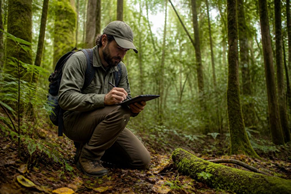
True offline-first design means all data, including photos, annotations, GPS coordinates, and metadata, is written to local device storage first. Synchronization to cloud-based storage happens opportunistically when connectivity is restored, with conflict resolution logic to handle cases where the same record was modified in multiple locations.
Before deploying any mobile data collection software on remote sites, test the full workflow with airplane mode enabled. Capture data, close the app, reopen it, and verify nothing was lost. Then restore connectivity and confirm sync completes without data loss or duplication.
According to Canada’s Digital Government standards for data management, federal field operations are increasingly required to demonstrate data continuity and auditability, which makes offline-first synchronization a compliance consideration, not just a convenience feature.
Never assume an app’s “offline mode” is fully functional without testing it in the actual field conditions you’ll face. Some tools cache form data but fail to retain attached photos when connectivity drops. Discovering this after a full day of fieldwork means losing irreplaceable site documentation.
Data Quality Assurance in Fieldwork
Data quality in fieldwork degrades at three points: during capture, during transmission, and during storage. Most quality assurance frameworks focus on the last stage, which is exactly backwards. Data integrity is best protected at the point of capture, before errors propagate downstream. Automatic metadata attachment removes the most common source of error: manual transcription. Structured data entry through predefined form fields eliminates ambiguity in categorical data.
Data Validation and Sampling Techniques
Effective validation techniques for field surveys include:
- Range checks: Flag numeric entries outside expected bounds
- Duplicate detection: Alert field personnel when a location or asset ID has already been recorded in the current session
- Mandatory field enforcement: Prevent form submission without required inputs, particularly GPS confirmation and photo attachment
- Cross-field validation: Verify that related fields are internally consistent
For quantitative research requiring statistical validity, random sampling protocols with documented selection criteria are standard. For qualitative research and observational fieldwork, purposive sampling (selecting locations based on specific characteristics) is more appropriate. The key is documenting the sampling methodology in the metadata so results are reproducible and defensible.
As documented in Statistics Canada’s guidance on survey methodology, sampling design decisions made before fieldwork begins have a larger impact on data accuracy than any post-collection cleaning process.
Post-Collection Data Cleaning Workflows
A practical cleaning workflow for field data follows four stages:
- Deduplication: Remove or merge duplicate records created by sync errors or double-entry
- Completeness check: Identify records missing required fields and flag for follow-up before field teams disperse
- Coordinate verification: Cross-check GPS coordinates against known site boundaries to catch obvious location errors
- Metadata normalization: Standardize date formats, location naming conventions, and categorical labels across all records
The window for effective cleaning is narrow. Field personnel who captured the data can clarify ambiguities immediately after the session; two weeks later, that context is gone. Build the cleaning workflow into the same day as data capture wherever possible.
Export your field session data immediately after returning from site, before syncing to shared cloud-based storage. This creates a local backup that preserves the original capture state, which is invaluable if sync errors corrupt or overwrite records.
Digital Field Survey Templates That Speed Up Data Capture
Digital field survey templates are pre-built data capture forms that standardize what information is collected, in what format, and in what sequence. They eliminate the blank-page problem in the field and dramatically reduce the cognitive load on field personnel.
The best templates are designed around the specific workflow, not generic form-building logic. For a construction site inspection, the template should mirror the physical walkthrough sequence: site perimeter first, then structural elements, then MEP systems, then deficiency documentation.
Effective digital field survey templates share these characteristics:
- Session-based organization: All captures within a single site visit are grouped under a unique key, making retrieval and reporting straightforward
- Photo-first capture: The primary input is a photo, with structured fields and annotations attached
- Conditional logic: Fields that only appear when relevant
- Exportable outputs: Templates that generate formatted reports directly
PhotoLog’s session-based key system addresses a real operational problem: field personnel documenting multiple sites in a single day routinely mix up photos without a clear organizational anchor. Assigning a unique key per session keeps every capture, annotation, and GPS coordinate grouped and instantly searchable by event or date.
The National Research Council Canada’s construction inspection guidelines reference standardized documentation practices as a baseline requirement for site compliance reporting, which underscores why template design matters beyond just operational convenience.
Data Security and Privacy Compliance in Field Operations
Field data security is a different problem than office data security, and most organizations treat it as an afterthought.
The risk profile in field operations includes device loss or theft, unencrypted data transmission over public or cellular networks, unauthorized access to photos containing sensitive site or personal information, and inadequate access controls when multiple team members share devices.
In Canada, organizations collecting field data that includes personal information are subject to the Personal Information Protection and Electronic Documents Act (PIPEDA) at the federal level, with provincial equivalents in Alberta, British Columbia, and Quebec. For environmental and infrastructure projects, additional data governance requirements may apply under sector-specific regulations.
Practical security controls for field data collection operations:
- Device-level encryption: All field devices should have full-device encryption enabled before deployment
- Access controls: App-level authentication prevents unauthorized access if a device is lost
- Selective GPS disclosure: Location data for sensitive sites should be controlled and not automatically shared with third-party cloud services without explicit consent
- Data minimization: Collect only the location and personal data required for the specific project
PhotoLog’s switchable GPS capability directly supports data minimization principles: teams can disable location tracking when GPS data isn’t required for a specific session, reducing the personal data footprint without disrupting the rest of the documentation workflow.
Data security in field operations starts with device configuration, not app settings. Encrypt devices, enforce authentication, and establish a clear data retention policy before the first field session begins. Retrofitting security controls after a data incident is far more expensive than building them in upfront.
Efficient Field Data Collection Methods: Common Mistakes to Avoid
Most failures in field data collection are predictable.
Skipping pre-field equipment checks. GPS accuracy, battery charge, available storage, and app sync status should be verified before leaving for site. A five-minute pre-flight checklist prevents hours of data recovery work.
Relying on connectivity that isn’t guaranteed. Any workflow that requires real-time data transmission to function will fail on remote or semi-urban Canadian sites. Offline-first data synchronization is the baseline.
Inconsistent naming and keying conventions. When field personnel use different session keys, location names, or date formats, post-collection data cleaning becomes a manual reconciliation exercise. Standardize conventions before deployment and enforce them through template design.
Capturing photos without metadata. A photo without a GPS coordinate, timestamp, and session reference is nearly useless for compliance reporting. Automatic metadata attachment at capture is the only reliable way to ensure this doesn’t happen.
Delaying data export and cleaning. The longer the gap between capture and cleaning, the harder it is to resolve ambiguities. Same-day export and a rapid completeness check should be standard operating procedure.
Over-engineering the template. Templates with too many fields slow down field personnel and increase the rate of skipped or inaccurate entries. The right template captures exactly what’s needed, in the order it’s needed, with no unnecessary friction.
Ignoring data governance until there’s a problem. PIPEDA compliance, data retention schedules, and access controls are not bureaucratic overhead; they’re the framework that makes field data legally defensible. Build governance into the workflow from day one.
Field documentation gets complicated fast when the tools don’t match the conditions. PhotoLog was built specifically for field personnel who need automatic geotagging, timestamped photo capture, voice and typed annotations, and formatted exportable reports, all from an Android device, whether or not there’s cell service. For construction inspectors, environmental consultants, and infrastructure managers across Canada who need documentation that holds up under scrutiny, PhotoLog provides the precision and organization that generic camera apps can’t match. Download PhotoLog free and see how it fits your next field session.
Frequently Asked Questions
What are the most efficient field data collection methods for construction and inspection work?
The most efficient field data collection methods combine mobile data capture with automatic metadata tagging. For construction and inspection work, this means using a mobile app that geotags photos, timestamps entries, and attaches typed or dictated notes at the moment of capture. Organizing captures by session or site key lets field personnel search records instantly rather than sorting through hundreds of unnamed files later. Pairing this with exportable formatted reports removes a separate manual step from the workflow.
How do you ensure data quality during remote field collection in Canada?
Data quality assurance in fieldwork depends on three controls: validation at the point of entry, consistent survey templates that enforce required fields, and a post-collection cleaning step before data enters your project management or reporting system. In Canada's remote regions where cell service is unreliable, offline-capable tools that queue and sync records once connectivity returns are essential. GPS coordinates should be verified against known reference points before relying on location data for compliance submissions or official reports.
What are the best practices for offline data synchronization in remote areas?
Store all captured data locally on the device first, never depend on a live connection to save a record. Use an offline-first app that queues photos, annotations, and location data in a local database, then syncs automatically when connectivity is restored. Before heading into the field, pre-load any required templates or reference data. After returning to coverage, verify that record counts match between the device and cloud-based storage before clearing local copies. This prevents data loss in areas with no LTE or Wi-Fi access.
How does mobile data collection software improve field efficiency?
Mobile data collection software cuts the double-handling that paper and manual entry create. Capturing a photo, location, timestamp, and notes in one action replaces a process that previously required a camera, a paper form, a GPS unit, and a separate data entry session back at the office. Searchable records organized by project key or date mean retrieval takes seconds rather than minutes. For teams running multiple concurrent sites, real-time data visibility also lets supervisors flag issues before they escalate.
Will a field data collection app work when there's no cell service on site?
Yes, provided the app is built on an offline-first architecture. The app should save every photo, annotation, and GPS coordinate directly to the device's local storage, independent of any network connection. Data synchronizes to cloud-based storage automatically once the device reconnects. Before relying on any tool for compliance-critical fieldwork, test it explicitly in airplane mode: capture several records, confirm they save locally, then reconnect and verify the sync. Apps that require a live connection to save are unsuitable for remote Canadian field conditions.
What data privacy rules apply to field data collection in Canada?
Organizations collecting personal information through field surveys or inspections in Canada must comply with the Personal Information Protection and Electronic Documents Act (PIPEDA) at the federal level, and with provincial privacy legislation where it applies, including Alberta's PIPA and British Columbia's PIPA. Practically, this means collecting only the data you need, storing it securely, and controlling who can access it. For field tools, look for switchable GPS so location data is only captured when required, and confirm that any cloud storage provider meets Canadian data residency requirements.
This article was written using GrandRanker