Table of Contents
- Why Dense Forests Block GPS Signals
- Step 1: Check Your Device and Satellite Constellation Settings
- Step 2: Improve Device Positioning and Orientation
- Step 3: Use an External GPS Antenna for Smartphones
- Step 4: Apply GPS Multipath Error Mitigation Techniques
- Step 5: Best Practices for Field Data Collection in Forests
- Common Mistakes to Avoid When Troubleshooting GPS Signal Loss
- Frequently Asked Questions
Last Updated: September 30, 2026
Why Dense Forests Block GPS Signals
Troubleshooting GPS signal loss in dense forests starts with one hard truth: trees block the radio waves your phone depends on. Your device listens for faint L-band signals from satellites orbiting roughly 20,000 km away, and a closed canopy of wet leaves and trunks can absorb or scatter most of that signal before it reaches you.
Natural Resources Canada guidance on GNSS positioning
How Canopy Cover and Foliage Density Affect Reception
Foliage density decides how much signal survives the trip down. A sparse pine stand lets more through than a mature cedar thicket.
Step 1: Check Your Device and Satellite Constellation Settings
Start with settings, because they cost nothing to fix. Many devices ship with only GPS enabled when they could be reading far more satellites.
- GPS (United States)
- GLONASS (Russia)
- Galileo (European Union)
- BeiDou (China)
A cold start in heavy canopy can take several minutes. Turn your device on and let it acquire satellites in an open area before you walk into the trees. A hot start under canopy is far faster than a cold one.
Step 2: Improve Device Positioning and Orientation
Where you hold the device matters as much as what it’s reading. Your body blocks satellite signals, and so does the ground.
Try these positioning habits:
- Hold the device away from your body, not against your chest
- Keep it flat or angled slightly toward open sky
- Move to a clearing, trail edge, or streambank when you need a fix
- Wait 30 to 60 seconds in one spot instead of walking while logging
Step 3: Use an External GPS Antenna for Smartphones
An external GPS antenna for smartphones is the single biggest hardware upgrade for forest work: it moves the receiver away from your body and up toward canopy gaps. Here is what actually matters when you buy and deploy one. Ensuring the connection remains stable is essential, as even the most robust external receiver cannot compensate for internal faults that require you to troubleshoot smartphone hardware issues before heading into the field.
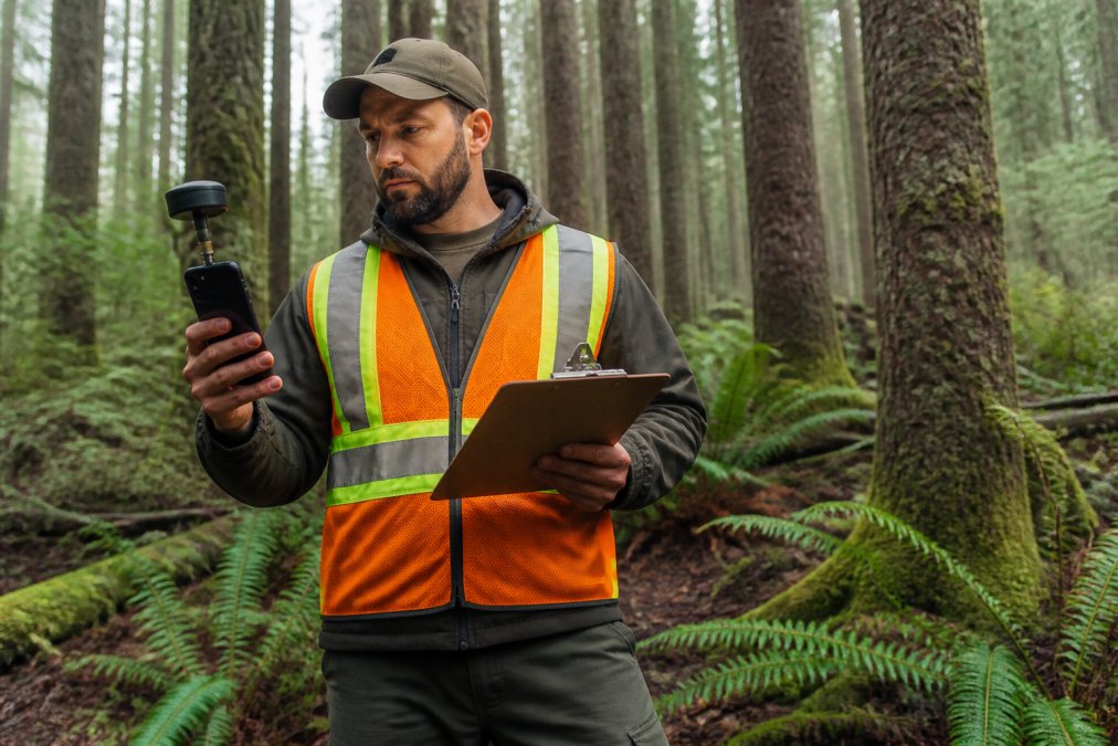
The three hardware classes you will actually encounter
- Bluetooth pucks (also called GNSS receivers or loggers). A self-contained unit with its own antenna and chipset that pairs to your phone over Bluetooth Classic or Bluetooth Low Energy. Examples include the Garmin GLO series, the Bad Elf GPS Pro line, and the Dual Electronics XGPS series. They output NMEA 0183 sentences over a serial-over-Bluetooth profile, which your mapping app reads as if it were the phone’s internal receiver.
- Wired Lightning/USB-C receivers. Smaller units that draw power from the phone and skip the Bluetooth pairing step. Fewer pairing failures, but the cable is a snag hazard in brush.
- Pole-mounted receivers with external antenna ports. Higher-end survey gear (for example, units that accept a TNC or SMA antenna connector) that lets you raise the antenna on a range pole. This is the configuration that most reliably clears understory.
What to look for on the spec sheet
- Multi-constellation support. Confirm the unit tracks GPS, GLONASS, Galileo, and BeiDou; a GPS-only receiver will underperform your phone in canopy.
- Update rate. 1 Hz is the minimum; 5 Hz or 10 Hz gives you more samples per point when you log for 30 to 60 seconds.
- SBAS support. Look for WAAS/EGNOS/MSAS compatibility. In Canada, WAAS (the North American SBAS) is the relevant correction service, and it is free.
- Antenna type. A patch antenna is compact; a helical or quadrifilar helix antenna holds a fix better at low elevation angles, which matters when the only sky you can see is straight up through a gap.
- Battery life. Bluetooth pucks run 8 to 20 hours depending on update rate. Carry a USB power bank sized to match.
Setup sequence that avoids the common failures
- Charge the receiver fully before the field day.
- Pair it to the phone in open sky, not under canopy, so the initial fix is clean.
- In your mapping app, select the external receiver as the location source. On Android this is usually done inside the app’s GNSS settings, not the system settings.
- Confirm the app is receiving NMEA data by checking the satellite page or the fix status indicator.
- Walk into the canopy and watch the horizontal accuracy estimate for two to three minutes before you trust it.
Realistic expectations
A pole-mounted multi-constellation receiver will not give you survey-grade accuracy under a closed canopy. What it gives you is a fix that holds instead of dropping, with horizontal error often in the 3 to 8 meter range instead of the 15 to 30 meters a phone alone may see, the difference between a usable point and one you throw out.
A cheap antenna with poor sensitivity can perform worse than your phone alone. Test any new antenna in open sky first, then compare fixes under canopy before trusting it on a paid job. Also check the Bluetooth range: most pucks are rated to about 10 meters line-of-sight, which shrinks fast when your body and wet foliage are between the puck and the phone.
Pairing it with your workflow
Once the external receiver feeds your phone, the same discipline applies: stop, wait, and log multiple readings. The receiver buys a better signal, not a better habit.
Step 4: Apply GPS Multipath Error Mitigation Techniques
Multipath error mitigation is about reducing the false signals that bounce off trees. You can’t remove the trees, but you can reduce their effect.
Practical techniques include:
- Log each point for 30 to 60 seconds so the receiver can filter outliers
- Use differential GPS or post-processing to correct drift after the fact
- Record a logging frequency that captures multiple readings per point
- Note the time and conditions so you can flag suspect coordinates later
Step 5: Best Practices for Field Data Collection in Forests
Best practices for field data collection come down to planning and backup. The forest will test your workflow, so build in room for error, the sections below cover the two things that actually determine whether your day succeeds.
Cache offline maps before you lose the signal
Signal acquisition gets all the attention, but once you are permanently under canopy, your navigation problem changes from “how do I get a fix” to “how do I navigate without one.”
- Download map tiles in advance. In Google Maps, save a region with the offline maps feature before you leave cell range. In Gaia GPS, CalTopo, and Organic Maps, download the layers you need (topo, satellite, or both) at the zoom levels you will use. Tile packs for a full day’s survey area can run several hundred megabytes, so budget storage.
- Carry a paper backup. A printed topo map and a baseplate compass cost nothing to carry and work when every battery is dead. If you are doing compliance or boundary work, a paper record of your track is also useful evidence.
- Record a track, not just waypoints. A continuous track log lets you reconstruct your route even if individual points are noisy. Most apps export tracks as GPX, which you can open later in QGIS, Google Earth, or your client’s GIS.
- Set your app to offline mode explicitly. Some apps silently try to fetch tiles and fail, leaving you with a blank screen. Force offline mode before you enter the trees.
Battery optimization during signal hunting
Searching for satellites keeps the GNSS chipset, screen, and often the cellular radio active at once. A phone that lasts two days in your pocket can die in three to four hours under canopy. Practical measures:
- Airplane mode between logging bursts. This kills the cellular radio’s constant search for towers, which is a major drain in remote areas. Your GNSS chipset still works in airplane mode.
- Lower screen brightness and shorten the screen timeout. The display is often the single largest draw.
- Close unused apps. Background sync, email, and social apps wake the radio repeatedly.
- Use a dedicated GNSS app that can run with the screen off. Many mapping apps continue logging in the background; confirm yours does before you rely on it.
- Carry a power bank sized for the day. A 10,000 mAh bank will typically recharge a phone one to two times. For multi-day work, a 20,000 mAh bank or a solar panel is worth the weight.
- Consider a dedicated handheld or external receiver. Devices like the Garmin GPSMAP series or a Bluetooth GNSS puck run 12 to 20 hours on their own battery, taking the load off your phone.
Post-processing: cleaning up jumpy tracks after the fact
If you recorded raw data or a GPX track, you can improve it after returning from the field.
- Filter outliers. Most GIS and GPS software (QGIS, GPSBabel, Garmin BaseCamp) can apply a speed or distance filter that removes points implying impossible movement.
- Smooth the track. A moving-average or Kalman filter smooths the zigzag that multipath creates without moving the overall route.
- Differential correction. If you logged raw observations and have access to a nearby base station (for example, a provincial or federal CORS station), you can post-process to tighten accuracy. Natural Resources Canada operates a network of continuously operating reference stations that support this kind of correction.
- Document your corrections. Note in your field report which points were filtered or corrected, so the record stays defensible.
The rest of the field discipline
- Log points in a consistent order so records stay traceable.
- Capture a photo at each point to confirm the location visually.
- Export and back up data the same day, before the device is lost, dropped, or wiped.
- Note weather and canopy conditions at each point so you can flag suspect coordinates later.
For documentation, PhotoLog turns your Android device into a field tool that geotags and time-stamps each image automatically. You can add typed or dictated notes, search by key or date, and export a formatted Field Report. That keeps your location data tied to visual evidence, even when the fix is imperfect.
| Problem | Fix | Impact |
|---|---|---|
| Weak signal under canopy | Enable multi-constellation tracking | More satellites, faster fix |
| Multipath bounce | Log longer, use post-processing | Tighter coordinate precision |
| Body blocking signal | Use an external antenna | Clearer sky view |
| Fast battery drain | Airplane mode between logs | Longer field sessions |
| No signal at all | Pre-cached offline maps + paper backup | Navigation continues without a fix |
| Jumpy track after the fact | Filter and smooth in GIS software | Cleaner, more defensible data |
Common Mistakes to Avoid When Troubleshooting GPS Signal Loss
The biggest mistake is trusting a single reading. One fix under heavy canopy can be off by several meters, and logging it unchecked sends that error straight into your report.
Other common errors:
- Walking while logging instead of stopping to let the receiver settle
- Ignoring wet foliage conditions and assuming yesterday’s accuracy holds
- Skipping offline map caching, then losing navigation when cell service drops
- Failing to verify the fix before relying on it for compliance work
Stop, wait, and log multiple readings at each point. Patience at the point of capture beats any correction you try to apply later.
Frequently Asked Questions
Why does my GPS keep losing signal under tree cover?
GPS signals are radio waves in the L-band frequency, and dense canopy cover blocks or weakens them. Water in leaves and needles absorbs signal energy, while trunks and branches cause multipath interference where signals bounce before reaching your device. The result is signal attenuation that makes it hard for your receiver to maintain a fix. Using an external antenna and logging data at higher frequency can help maintain accuracy in these conditions.
Can dense foliage completely block satellite signals?
Complete blockage is rare but possible in old-growth forests with multiple canopy layers. What usually happens is partial blockage: your device sees fewer satellites, and the ones it does lock onto have weaker signal-to-noise ratios. This leads to positional drift and inaccurate fix accuracy. If you need reliable coordinates for compliance reports, try moving to a small clearing or using a device with higher receiver sensitivity.
What is the difference between GPS signal loss and signal drift?
Signal loss means your device cannot acquire enough satellites to calculate a position at all. Signal drift happens when your device maintains a fix but the coordinates wander, often by 10 to 30 meters, because it is triangulating from weak or bounced signals. Drift is more common under canopy cover and can be reduced by logging at higher frequency, using differential GPS corrections, and avoiding multipath sources like steep terrain or wet foliage.
How can I verify my geotagging is working before relying on it for official reports?
Before heading into the field, test your setup in an open area where you know the exact coordinates. Compare your device’s reading to a known reference point. Once in the forest, check that your app shows a stable fix accuracy and that coordinates do not jump between readings. Apps like PhotoLog let you switch GPS on and off, so you can confirm each photo is tagged correctly before you rely on it for compliance documentation.