Table of Contents
- Why Secure Photo Documentation Matters for Engineering Projects
- Geotagged Photo Documentation Best Practices
- Construction Site Photo Management Software: Core Features
- Digital Evidence Management for Engineering: Security and Compliance
- Legal Protection and Liability Mitigation Through Visual Records
- simplifying Field-to-Office Workflows with Professional Reporting
- Implementation: Getting Your Team Started with Secure Documentation
- Conclusion
Last Updated: August 24, 2026
Why Secure Photo Documentation Matters for Engineering Projects
Visual records are foundational to project accountability, compliance, and dispute resolution. When a defect appears months after handoff or a client questions whether work met specifications, photos provide evidence that memory cannot.
The challenge isn’t capturing images, it’s capturing them with location data, timestamp, and metadata. A photo without these elements is just a picture. A photo with automatic GPS tagging, precise time stamping, and searchable annotations becomes evidence. That distinction matters when liability is on the line.
Engineering firms face specific pressures that general photography doesn’t address. Environmental consultants need GPS coordinates accurate enough for regulatory compliance. Infrastructure managers must prove maintenance occurred on schedule. Project supervisors must generate professional reports from field data without spending hours organizing folders. Secure photo documentation transforms an Android device into a professional-grade documentation tool that handles all of this automatically.
Secure photo documentation converts raw field images into admissible evidence by automatically capturing GPS location, timestamp, and searchable metadata, eliminating the “I think this was taken here, sometime in May” problem that undermines liability protection.
Geotagged Photo Documentation Best Practices
Geotagged photo documentation attaches precise geographic coordinates to every image, creating a verifiable location record essential for compliance, site tracking, and dispute resolution. Without geotagging, a photo is just a picture. With it, it’s a timestamped, location-verified record.
The core benefit is accountability. When an inspector documents a crack in a foundation, the GPS tag proves exactly where that crack is located. Environmental consultants can prove they collected samples at specified coordinates. Infrastructure managers can verify that maintenance occurred at the correct asset location.
Accuracy matters more than convenience. Consumer-grade GPS is typically accurate to within 5-10 meters, acceptable for most construction documentation ([EXTERNAL_LINK: FCC Public Attachments | docs.fcc.gov]). For environmental compliance or precise infrastructure mapping, you may need accuracy within 1-3 meters ([EXTERNAL_LINK: EPA National Environmental Publications Information System | nepie.epa.gov]). Before deploying any tool, verify its GPS accuracy meets your regulatory requirements.
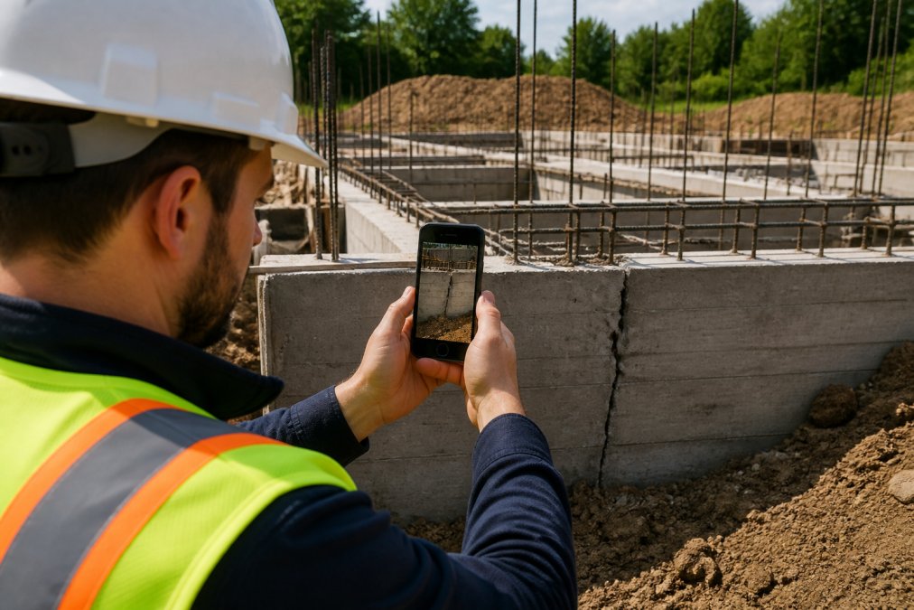
Implement these practices to maximize geotagged documentation:
- Enable GPS by default, but allow manual override. Some projects require privacy controls. PhotoLog offers switchable GPS, letting teams toggle location capture based on project requirements.
- Capture metadata consistently. Time, date, GPS coordinates, and user-entered notes should be automatic to prevent gaps in your audit trail.
- Organize by session or event key. Group related photos together so you can retrieve all documentation from a specific inspection in seconds.
- Verify accuracy before relying on it for compliance. Test GPS performance in your typical work environment, especially in dense urban areas or heavily wooded sites where signal quality may vary.
- Export with full metadata intact. When sharing reports with clients or regulators, ensure GPS data, timestamps, and annotations travel with the images.
A common mistake is treating geotagging as optional. Teams often disable GPS to save battery, then regret it when they need to prove where work occurred. The time saved is measured in seconds. The liability exposure is measured in thousands.
Construction Site Photo Management Software: Core Features
Construction site photo management software centralizes visual documentation, making images searchable, organized, and ready for reporting. The right platform transforms chaotic folders of photos into a structured asset that serves inspectors, project managers, and clients.
Automatic GPS Tagging and Metadata Capture
Every photo should automatically capture GPS coordinates, timestamp, and device information the moment the shutter clicks. Manual entry of this data is error-prone and defeats the purpose of documentation.
PhotoLog captures GPS location, date, time, and device information automatically. This metadata becomes part of the image file, traveling with it through exports, shares, and archives. The software must write EXIF data correctly so that any third-party tool, GIS software, compliance platforms, or image viewers can read location and timestamp information.
Real-Time Searchability and Organization
A photo library is only useful if you can find what you need in seconds. Real-time searchability by date, event key, or typed notes transforms a folder of 500 images into a navigable asset.
PhotoLog enables instant searchability by session key or date. Type "foundation inspection March 15" and every photo from that session appears. Search must be local-first, if your app requires internet connectivity to search photos you’ve already captured offline, you’re adding friction to field workflows where cell service is often unreliable.
Offline Access and Data Synchronization
Field teams frequently work in remote areas where cell service is unreliable or unavailable. The software must function completely offline, capturing, organizing, and annotating photos without any internet connection. Synchronization should occur automatically when connectivity returns.
PhotoLog operates fully offline. Photos, GPS data, and notes are stored locally on the device. When the device reconnects to the network, synchronization happens automatically. This local-first storage with cloud synchronization eliminates the "I lost all my photos because I was out of service" scenario.
Apps that require internet connectivity to save photos create a critical vulnerability in field documentation. If service drops mid-project, you risk losing data or being unable to document work. Always verify that the tool you choose functions completely offline and syncs automatically when connectivity returns.
Digital Evidence Management for Engineering: Security and Compliance
Photos documenting construction defects, environmental conditions, or infrastructure maintenance are sensitive records. They’re evidence in potential disputes, regulatory compliance demonstrations, and insurance claims. Security is foundational.
Data Encryption and Access Controls
Every photo and report must be encrypted in transit and at rest. Encryption in transit means data is scrambled while traveling between your device and cloud storage. Encryption at rest means data stored on servers is unreadable without authorization.
Access controls determine who can view, edit, or export documentation. A project supervisor might need access to all site photos, while a client should only see approved reports. The software must allow granular permission assignment.
PhotoLog stores data with encryption and offers privacy controls through switchable GPS. Verify whether your firm’s compliance requirements are met.
Audit Trails and Version Control
An audit trail documents who accessed what, when, and what changes were made. This becomes critical if a photo’s authenticity is questioned. Version control ensures that if a report is revised, previous versions remain accessible and dated.
The system must maintain a complete record of all access and modifications. If an inspector uploads a photo on March 15 and a project manager exports it on March 20, both actions should be logged with timestamps.
Before deploying any photo documentation system, confirm that it meets your firm’s compliance requirements. If you’re subject to ISO 27001, SOC2, or other data security standards, verify that the platform’s security architecture aligns with those requirements.
Legal Protection and Liability Mitigation Through Visual Records
Disputes in construction and engineering projects often hinge on what was documented and when. A geotagged, timestamped photo with metadata intact is far more defensible than a verbal recollection or undated image.
Visual records create an objective record of site conditions at specific moments. If a defect emerges months after completion, a photo taken during the project proves the condition at that time. If a client disputes whether work met specifications, before-and-after photos with timestamps provide evidence. If equipment maintenance is questioned, a photo with GPS coordinates and timestamp proves the work occurred at the correct location on the correct date.
The legal weight of visual evidence depends on metadata integrity. A photo stripped of GPS data and timestamp is weaker than one with full metadata intact. ZIP files that preserve all metadata are more defensible than JPEG exports that lose information.
Engineering firms in environmental or infrastructure roles face additional requirements. Regulatory agencies often demand proof that inspections occurred at specified locations on specified dates. GPS-tagged photos with intact metadata satisfy these requirements directly.
Simplifying Field-to-Office Workflows with Professional Reporting
The real productivity gain comes from eliminating manual report compilation. Field teams capture photos and notes. The software generates formatted reports automatically.

PhotoLog’s built-in Field Report feature converts captured photos and annotations into formatted reports ready for client delivery or regulatory submission. Instead of spending hours organizing photos and writing descriptions, inspectors export a ZIP file containing organized images and a formatted report.
The workflow becomes: capture photos with automatic metadata → add typed or voice notes → export formatted report. No intermediate steps. No manual organization.
Professional formatting matters for client perception. A report with properly organized photos, clear timestamps, and legible annotations looks credible. When reports are automatically formatted with consistent styling, clients perceive higher professionalism.
Implementation: Getting Your Team Started with Secure Documentation
Rolling out a new documentation system requires planning. Here’s how to move from decision to deployment without disrupting field operations.
Phase 1: Pilot with a single project or team (2-4 weeks)
Start small. Choose one project or a subset of inspectors to test the system. This allows you to identify workflow issues, verify GPS accuracy in your typical work environment, and train staff without affecting all operations.
Had the pilot team use PhotoLog alongside your existing documentation system for the first week. By week two, transition to PhotoLog as the primary tool. Document what works and what doesn’t. Does GPS accuracy meet your needs? Are field teams comfortable with the interface? Does the export format work with your reporting software?
Phase 2: Expand to additional teams (4-8 weeks)
Once the pilot team is confident, expand to additional inspectors or projects. Use the pilot team as internal advocates. Provide hands-on training for new teams, spend 30 minutes with each team member on their first project.
Monitor adoption metrics. Are teams using all features or just basic photo capture? Are they organizing by session key? Early adoption patterns reveal where additional training is needed.
Phase 3: Full deployment and integration (ongoing)
Once teams are comfortable, integrate the system into your standard workflows. Update project procedures to specify that all site documentation uses PhotoLog. Establish data retention and archival procedures matching your warranty or regulatory requirements.
| Implementation Phase | Timeline | Key Actions | Success Metric |
|---|---|---|---|
| Pilot | 2-4 weeks | Deploy to one team, test GPS accuracy, collect feedback | Pilot team confident, no critical issues |
| Expand | 4-8 weeks | Train additional teams, monitor adoption, refine workflows | 50-75% of field staff actively using system |
| Full Deployment | Ongoing | Integrate into standard procedures, archive old data, optimize workflows | 100% adoption, measurable time savings, zero data loss |
A common implementation mistake is rolling out too fast. Teams revert to old habits if they don’t have time to practice. Allocate 4-8 weeks for full adoption across your organization.
The real productivity gain from secure photo documentation comes not from capturing photos faster, but from eliminating hours spent organizing, searching, and manually compiling reports. Implementation success depends on training, not just software deployment.
Conclusion
Secure photo documentation transforms field work from anecdotal record-keeping to defensible evidence. Every photo carries the metadata that proves when it was taken, where, and what was documented. That eliminates the liability exposure that comes with undocumented or poorly documented work.
For engineering firms, environmental consultants, infrastructure managers, and project supervisors, the business case is straightforward: reduce time spent organizing and reporting, improve compliance documentation, and protect your firm from liability disputes.
PhotoLog is purpose-built for this workflow. Automatic GPS tagging, time/date stamping, instant searchability, and built-in Field Report generation handle the technical requirements. Offline-first architecture ensures documentation continues in areas with poor connectivity. Switchable GPS and permission controls protect sensitive site data. The result is a professional-grade documentation system that runs on an Android device.
Frequently Asked Questions
How does secure photo documentation protect engineering firms from liability disputes?
Secure photo documentation creates an immutable visual record with precise timestamps, GPS coordinates, and metadata that establishes exactly what conditions existed at a specific moment. This evidence-based documentation prevents disputes by providing objective proof of site conditions, defect locations, and project progress. When photos are encrypted and stored with audit trails showing who accessed them and when, they become legally defensible records that protect your firm against false claims or conflicting accounts of what occurred on site.
What makes geotagged photo documentation more accurate than manual site notes?
Geotagged photo documentation automatically captures precise GPS coordinates, timestamps, and metadata without manual data entry. This eliminates human error in recording location and time information. For environmental surveys, infrastructure inspections, and compliance documentation, this accuracy is critical, coordinates can be verified against project maps, and timestamps create an unambiguous chronological record. Manual notes rely on memory and handwriting, which are prone to mistakes and difficult to defend in disputes or regulatory reviews.
Can construction site photo management software work offline in remote areas?
Yes, modern construction site photo management software operates fully offline. Photos, GPS data, and annotations are captured and stored locally on your device even without cell service. Once connectivity is restored, the app automatically synchronizes all data to secure cloud storage. This is essential for remote project sites, underground inspections, or areas with poor signal. Your data remains intact and searchable locally until the sync completes, ensuring no documentation is lost due to connectivity gaps.
What compliance standards should digital evidence management for engineering meet?
Digital evidence management systems should meet SOC 2 Type II certification for security controls, ISO 27001 standards for information security management, and industry-specific compliance requirements. In Canada, firms handling sensitive project data should ensure the platform meets Privacy Act requirements and provides data residency options. Additionally, your documentation system should maintain chain-of-custody protocols, audit trails, and access controls that satisfy professional engineering standards and potential regulatory or legal review requirements.
Start capturing secure, geotagged documentation today. Download PhotoLog free and see how much time your team saves on the first project. Professional field documentation doesn’t require expensive software or complex workflows, it requires the right tool built for how your team actually works.
This article was written using GrandRanker