Table of Contents
- What Is Automated Field Documentation?
- Key Benefits of Automated Field Documentation
- Alternatives to Manual Field Data Entry for Inspections
- Digital Transformation in Utility Field Operations
- Automated Reporting for Utility Infrastructure Maintenance
- Critical Features for Field Documentation Systems
- How to Implement Automated Field Documentation
- Conclusion
- Frequently Asked Questions
Last Updated: September 23, 2026
What Is Automated Field Documentation?
Automated field documentation is the practice of capturing, organizing, and reporting site data using mobile technology that automatically timestamps, geotags, and indexes visual and written information. For utility companies, this means field inspectors can photograph infrastructure, equipment, or work conditions and have those images instantly searchable, geotagged, and ready for compliance reporting without manual data entry.
The core difference is elimination of the paper-to-digital conversion step. Automated systems capture GPS coordinates, date, time, and inspector notes with every image at the moment of capture, eliminating the manual uploading, naming, and reporting that follows traditional photography.
PhotoLog transforms an Android device into a field documentation system, automatically geotagging and time-stamping images, organizing them by session keys for instant searchability, and generating formatted reports ready for client delivery or regulatory submission.
This matters because utility field operations generate hundreds of photos per site visit. Automated field documentation cuts the time spent on manual organization to a fraction while improving accuracy and compliance evidence.
Key Benefits of Automated Field Documentation
Automated systems deliver measurable operational improvements across three areas: time savings, data integrity, and compliance readiness.
Time savings come from eliminating manual workflows. Session-based organization groups all photos from a single site visit automatically, and searchable metadata lets inspectors find specific images in seconds instead of scrolling through hundreds of files.
Data integrity improves because automation removes human error. Automated systems record precise GPS coordinates and exact times at the moment of capture, eliminating the inaccuracy of manual timestamps and approximate coordinates, critical for infrastructure maintenance records and regulatory evidence.
Compliance documentation becomes straightforward. Regulatory bodies increasingly require timestamped, geotagged evidence of inspections and maintenance. Automated field documentation systems create an audit trail automatically. Every photo carries metadata proving who captured it, when, where, and what notes were attached. This evidence is far stronger than retrospective documentation written hours or days after fieldwork.
For utility companies, automated field documentation enables field crews to share organized, professionally formatted reports immediately after work completes.
Alternatives to Manual Field Data Entry for Inspections
Utility field teams have historically relied on three approaches to manage site documentation, each with distinct trade-offs for remote infrastructure work where connectivity is unreliable.
Spreadsheet-based systems (Excel, Google Sheets) require manual logging of site visits, times, and photo attachment. At scale, 200-300 photos per visit, this means hours of manual filing. Spreadsheets lack geotagging, create no audit trail, and require manual synchronization across team members.
Cloud-only platforms force inspectors to upload photos later and manually organize them online, delaying reporting and requiring reliable connectivity that utility field sites often lack. Inspectors at remote substations or transmission corridors may have no cell service for hours, forcing a choice between delayed uploads or data loss if connections drop mid-upload.
Offline-first mobile tools capture, organize, and prepare reports directly on the device, then sync when connectivity returns. PhotoLog operates entirely offline, images are geotagged using the device’s GPS, timestamped locally, and organized into searchable sessions. When connectivity returns, the entire session syncs to cloud storage or exports as a formatted ZIP file, eliminating the false choice between real-time documentation and field reliability.
Many utilities use asset management systems (SAP, Maximo), GIS platforms (ArcGIS, Smallworld), and work order systems that do not communicate with each other. Offline-first tools that export standard formats (ZIP files with images, CSV metadata, or GeoJSON coordinates) work around integration gaps without requiring custom API integrations, which can take weeks to configure and may not be supported for older legacy software.
For utility companies managing distributed infrastructure in areas with spotty coverage, offline-first mobile documentation is becoming the standard because it handles the reality of field conditions, provides precise geotagging for asset management, and generates compliance-ready documentation without dependency on real-time connectivity or complex system integrations.
Digital Transformation in Utility Field Operations
Digital transformation in utility operations means moving from paper-based or fragmented digital workflows to integrated systems where field data flows directly into asset management, GIS, and compliance records. Automated field documentation is foundational to this shift.
The integration challenge: CIM and GIS standards. Utility companies manage assets using the Common Information Model (CIM), an IEC standard for power system equipment, and Geographic Information Systems (GIS) for spatial asset mapping. Traditional operations rely on field crews completing paper forms or voice recordings, which are transcribed or manually entered into systems days later. This creates delays, prevents real-time decision-making, and introduces errors that corrupt asset records, a transformer location entered incorrectly in GIS, or equipment specifications mistyped in the asset database, can cascade through maintenance planning and outage response.
Automated field documentation makes field data immediately available with precise metadata. Geotagged photos with precise GPS coordinates are defensible in GIS. Automatic recording of date, time, and inspector ID satisfies CIM audit requirements. Geotagged photos with precise coordinates integrate directly into spatial databases for utilities using ArcGIS or other GIS platforms.
The compliance angle: audit trails for regulatory oversight. Utility operations are regulated by bodies like the National Energy Board (NEB). Regulators require documented evidence of inspections, maintenance, and asset condition assessments created at the time of inspection, not reconstructed weeks later. Automated field documentation creates an audit trail that regulators accept: timestamped photos, GPS coordinates, inspector identification, and voice or typed notes all captured in real time. This audit trail is evidence of when compliance occurred, which matters for regulatory reporting cycles.
Automated systems also enable better preventive maintenance by aggregating timestamped, geotagged inspection data into searchable, analyzable records. Manual systems scatter this data across paper forms, email, and office notes, making analysis more challenging.
Automated field documentation tools that export data in standard formats reduce adoption friction. PhotoLog’s ability to export organized ZIP files with formatted reports and geotagged image metadata lets inspectors share data through any channel, working around integration gaps. The key is that the field documentation tool should not become a data silo, data captured in the field must flow into the systems that manage assets and compliance.
Automated Reporting for Utility Infrastructure Maintenance
Automated reporting transforms raw field data into client-ready or regulatory-ready documents without manual compilation. For utility infrastructure maintenance, this capability is critical because reports must be precise, timestamped, and professionally formatted.
Manual reporting involves inspectors writing notes or voice memos, which a project coordinator converts into a formal report with photos, timestamps, and findings. This process introduces delays and transcription errors. Automated systems skip this step entirely.
PhotoLog’s Field Report feature generates formatted reports directly from captured images and annotations. The system automatically produces a report with images arranged chronologically, geotagged locations, timestamps, and inspector notes, ready for client delivery or regulatory submission without additional editing.
Automated reports create timestamped evidence of inspections and maintenance automatically. Manual reports, compiled weeks after the fact, are harder to defend because they lack contemporaneous documentation.
Automated reporting also enables consistency. Every report follows the same format, includes the same data fields, and carries the same metadata. This consistency matters for compliance audits and for training new inspectors, who can see exactly what a complete report looks like.
Critical Features for Field Documentation Systems
Not all field documentation tools work equally well for utility operations. The features that matter most reflect the specific demands of infrastructure work: offline capability, precise geotagging, compliance-ready metadata, and integration flexibility.
Offline-first operation is non-negotiable for utility field teams. Remote infrastructure sites often lack reliable cell service. A system that requires constant internet connectivity will fail in the field. PhotoLog operates entirely on the device, capturing and organizing data offline, then syncing when connectivity returns. This approach ensures inspectors never lose data due to signal loss.
Automatic geotagging with GPS accuracy matters because utility assets are geographically distributed. An inspection report without precise coordinates is incomplete. The system should capture GPS data at the moment of photo capture, not require manual entry. For environmental surveys or infrastructure mapping, this precision is often required by regulation.
Automatic date and time stamping creates the audit trail that compliance bodies demand. Manual timestamps are easily disputed. Automated timestamps tied to the device’s system time are defensible.
Session-based organization and searchability reduce the time inspectors spend managing files. Being able to search by date, location key, or inspector name means finding specific photos takes seconds, not minutes.
Export flexibility matters because utility companies use different downstream systems. The ability to export as ZIP files with formatted reports, or to integrate via APIs, prevents the tool from becoming a data silo. PhotoLog’s ZIP export approach works with any sharing method, reducing dependency on specific integrations.
Privacy controls are increasingly important as companies handle sensitive infrastructure data. The ability to disable GPS sharing when needed, or to control who can access exported reports, protects both the company and the infrastructure.
How to Implement Automated Field Documentation
Rolling out automated field documentation requires a structured approach. Rushing deployment often leads to adoption resistance and wasted investment. A phased implementation gives teams time to learn the workflow and see value before full rollout.
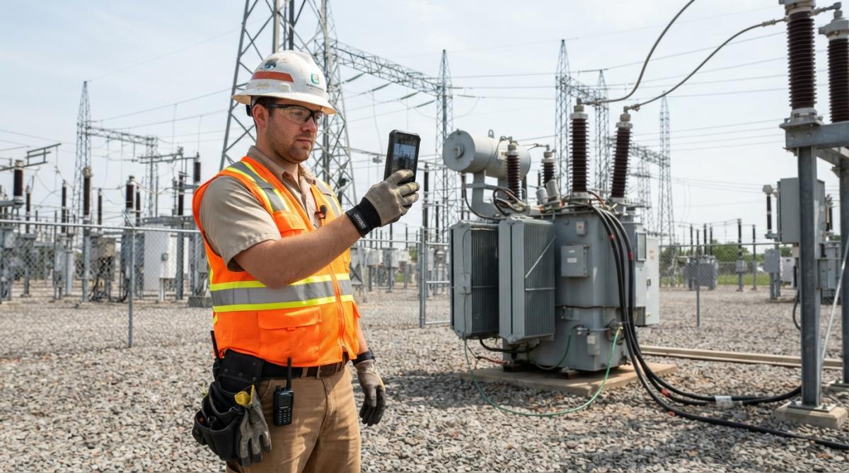
Phase 1: Select a pilot team and site. Choose 2-3 inspectors and one active project site. This small group tests the workflow without disrupting normal operations.
Conclusion
Automated field documentation eliminates the time-consuming manual workflows that slow down utility field operations. By capturing geotagged, timestamped images directly on mobile devices and organizing them into searchable sessions, field teams can reduce data entry time from hours to minutes while creating compliance-ready documentation automatically.
Frequently Asked Questions
How does automated field documentation improve regulatory compliance?
Automated field documentation creates permanent audit trails with time stamps, GPS coordinates, and timestamped notes that satisfy regulatory requirements. Systems generate formatted reports that meet standard operating procedures and compliance documentation standards. This eliminates gaps in manual record-keeping and ensures every site visit is fully documented for inspection by regulatory bodies.
Can automated field documentation work offline in remote areas?
Yes. Most modern field documentation tools operate offline-first, capturing all data locally on your device. GPS coordinates, photos, and notes sync automatically when connectivity returns. This is critical for utility inspectors working in areas with spotty cell service. Offline capability ensures you never lose data, even when working miles from network coverage.
What’s the difference between automated field documentation and manual data entry?
Manual data entry requires inspectors to photograph sites, then spend hours transcribing observations into spreadsheets or reports back at the office. Automated field documentation captures everything in real time: photos are automatically geotagged and timestamped, notes are dictated or typed instantly, and searchable reports generate automatically. This eliminates redundant work and reduces errors from transcription mistakes.
How accurate is GPS geotagging for compliance-critical surveys?
GPS accuracy in field documentation systems is generally sufficient for most utility infrastructure documentation. For surveys requiring higher precision, systems allow manual coordinate verification and integration with GIS platforms. Always test geotagging accuracy on your sites before deploying for official compliance reports.