Table of Contents
- Quick Comparison: Best Tools for Environmental Site Surveys
- How We Evaluated These Field Data Collection Tools
- 1. PhotoLog: Geotagged Photo Documentation for Field Teams
- 2. Fulcrum: Custom Forms and Automated Workflows
- 3. Mitti by SafetyCulture: Real-Time Environmental Monitoring
- 4. EHS Insight: Enterprise Environmental Data Management
- 5. ERA EH&S: Regulatory Compliance and Reporting
- 6. SurveySparrow: Affordable Offline Data Collection
- The Integration Gap Most Teams Miss
- Frequently Asked Questions
Last Updated: September 17, 2026
Quick Comparison: Best Tools for Environmental Site Surveys
Choosing the best tools for environmental site surveys comes down to one question: does the tool capture defensible field data and turn it into a report you can hand to a client or regulator without rework? This guide from PhotoLog breaks down six platforms that answer that question differently, from geotagged photo documentation to full enterprise compliance suites.
Quick Picks:
- Best Overall: PhotoLog, geotagged, time-stamped photo documentation with built-in Field Reports
- Best for Custom Forms: Fulcrum, offline-capable forms with automated workflows
- Best for Enterprise Compliance: EHS Insight, scalable environmental data management
| Tool | Free Tier | Pricing | Best For | Standout Feature |
|---|---|---|---|---|
| PhotoLog | Yes | Free download | Photo documentation | Geotagged Field Reports |
| Fulcrum | No | Contact for pricing | Custom field forms | Offline form logic |
| Mitti | No | Contact for pricing | Real-time monitoring | Sensor dashboards |
| EHS Insight | No | Contact for pricing | Large enterprises | Compliance modules |
| ERA EH&S | No | Contact for pricing | Industrial facilities | Regulatory reporting |
| SurveySparrow | Yes | From $19/month | Budget teams | Offline surveys |
How We Evaluated These Field Data Collection Tools
We scored each platform on five weighted criteria that matter in the field, not in a sales demo. The weighting reflects what actually causes survey rework: geotagging accuracy (25%), offline reliability (20%), reporting output (20%), compliance support (20%), and setup effort (15%). A tool that captures perfect data but takes three hours to configure rarely survives contact with a real project schedule, which is why setup effort carries real weight rather than being a footnote.
-
Geotagging accuracy: Does the tool record coordinates automatically, and can you verify them against a known control point? We look for sub-10-metre horizontal accuracy under open sky and a clear indication when the fix degrades.
-
Offline reliability: Can the app capture, queue, and sync without a connection, and does it warn you when a sync fails? Field teams working in remote or shielded locations cannot depend on live connectivity.
-
Reporting output: Does the tool produce a formatted, client-ready deliverable, or does it hand you raw data you must assemble by hand? The difference is often several hours per project.
-
Compliance support: Does the platform map to recognized environmental management frameworks, such as ISO 14001 environmental management systems or the documentation expectations in federal impact assessment guidance, or does it leave compliance mapping entirely to you?
-
Setup effort: How long before a new field technician is productive? Tools that require custom form logic or ERP integration carry a real onboarding cost.
-
Digital data collection and mobile apps for forms, photos, and chain-of-custody records
-
GIS integration to place every observation on a map and run spatial analysis
-
GPS and location tracking to anchor samples and readings to coordinates
-
Soil sampling and physical field equipment such as hand augers, split spoons, and dedicated sample containers
-
Vibration and acoustic noise measurement instruments for construction-adjacent or industrial sites
-
Aerial surveying and drone technology for site-scale imagery and inaccessible areas
-
Environmental monitoring sensors for groundwater, air quality, and continuous parameters
Test geotagging accuracy before you commit. Take a photo at a known landmark, check the coordinates against a mapping service, and repeat at three different sites. If the coordinates drift, your compliance reports will too.
Score every candidate tool against the same five weighted criteria, then map it to the physical and digital categories above. A tool that scores well in isolation but does not connect to the rest of your stack will cost you more in manual reconciliation than it saves in license fees.
1. PhotoLog: Geotagged Photo Documentation for Field Teams
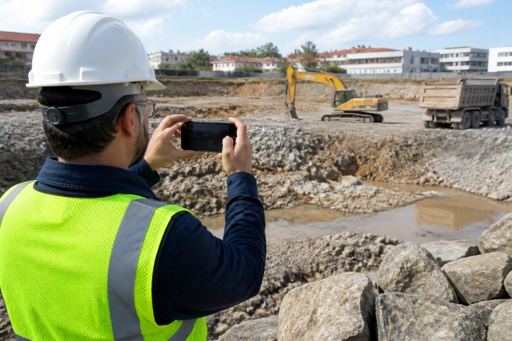
PhotoLog is our top pick because it solves the problem every environmental survey eventually hits: turning hundreds of field photos into organized, searchable, report-ready evidence. It transforms an Android device into a field documentation tool that automatically geotags and time-stamps every image.
Key Features
- Automatic GPS geotagging with switchable privacy control
- Typed and dictated notes attached to each photo
- Instant searchability by session key or date
- Exportable ZIP files with formatted Field Reports
- Automatic date and time stamping
Best For
Environmental consultants, home inspectors, and infrastructure managers who need precise, time-stamped visual evidence without a steep learning curve.
Pros and Cons
Pros: Fast setup, offline-friendly capture, professional report output.
Cons: It documents and organizes visual evidence rather than performing automated compliance calculations, so pair it with a dedicated compliance platform for regulatory submissions.
2. Fulcrum: Custom Forms and Automated Workflows
Fulcrum earns its place for teams that need structured data entry rather than photo-first capture. Its customizable mobile forms work offline, and automated workflow triggers push completed inspections toward compliance reporting.
3. Mitti by SafetyCulture: Real-Time Environmental Monitoring
Mitti targets organizations running continuous monitoring programs across multiple sites. Real-time dashboards, IoT sensor integration, and automated incident reporting make it a strong fit for ongoing environmental monitoring rather than one-off surveys.
4. EHS Insight: Enterprise Environmental Data Management
EHS Insight integrates environmental site data with broader health and safety programs. Emissions tracking, regulatory compliance modules, and mobile inspection tools sit inside one platform.
5. ERA EH&S: Regulatory Compliance and Reporting
ERA EH&S focuses narrowly on regulatory reporting, chemical and waste tracking, and real-time alerts. Industrial facilities with strict reporting obligations get the most from it.
6. SurveySparrow: Affordable Offline Data Collection
SurveySparrow closes the list as the budget option. Starting around $19/month, it offers conversational surveys, offline collection, and integrations with Slack, WordPress, and Zapier.
Do not use general survey tools for compliance-critical data. If a regulator asks for your survey methodology and calibration records, a consumer survey platform will not have them.
The Integration Gap Most Teams Miss
The real difference between a smooth survey workflow and a chaotic one is not the tool you pick. It is how your hardware and software talk to each other. Most ranking guides separate physical tools from digital tools, which is exactly why so many teams end up rebuilding the same connection by hand on every project. This section covers the two gaps competitors leave open: a unified tech stack and a rent-vs-buy framework for the expensive equipment.
Building a unified tech stack
A practical setup has four layers, and each layer should hand off to the next without manual re-entry:
- Capture layer: geotagged photos, dictated notes, and structured forms collected offline on a ruggedized device or smartphone.
- Measurement layer: soil sampling equipment, noise and vibration meters, and monitoring sensors that produce readings tied to a location and time.
- Sync and validation layer: a database that receives field records, flags missing coordinates or timestamps, and confirms the sync completed before the technician leaves the site.
- Reporting layer: a platform that turns validated records into a formatted deliverable, whether that is a Field Report or a regulatory submission.
Mapping tools to regulatory requirements
Few guides link specific tools to specific obligations, which is a major pain point for professionals. The mapping does not need to be complicated:
- Impact assessment documentation: federal guidance under the Impact Assessment Act expects a clear record of baseline conditions and effects. Geotagged photo documentation and structured field forms support that record directly.
- Environmental management systems: ISO 14001 expects documented procedures and records. A platform with audit trails and versioned reports fits here.
- Regulated facility reporting: facilities with strict reporting obligations benefit from automated reporting modules that produce consistent output, as documentation standards under federal compliance and enforcement frameworks continue to tighten.
- Chain of custody for samples: soil and water sampling records need to show who collected what, where, and when. Timestamped, geotagged records close that gap.
Rent vs. buy: a decision framework
High-end monitoring equipment is where budgets go wrong. A simple framework helps:
- Rent when the equipment is needed for a single project, the technology changes quickly, calibration and maintenance would be a burden, or the capital cost cannot be justified by utilization.
- Buy when the equipment is used on most projects, the technology is stable, you can absorb calibration and maintenance, and the payback period fits your project pipeline.
- Lease or subscribe when you need predictable costs and the vendor handles calibration and firmware updates.
Do not let a manual export step sit between your measurement layer and your reporting layer. If a regulator asks for your survey methodology and calibration records, a disconnected workflow will not produce them on demand.
Frequently Asked Questions
What tools are commonly used in environmental analysis?
Environmental professionals rely on a mix of field data collection apps, mobile GIS applications, and specialized monitoring software. PhotoLog handles geotagged photo documentation for site surveys, while platforms like Fulcrum and Mitti manage form-based data capture and compliance tracking. For report review, AI tools like Nomic AI can extract recognized environmental conditions. The right combination depends on whether your priority is visual documentation, sensor data integration, or regulatory reporting.
How do I ensure data privacy in field documentation apps?
Look for apps that offer switchable GPS controls, encrypted storage, and clear data retention policies. PhotoLog lets you toggle GPS on or off per session, so sensitive locations stay private when needed. Check whether the app stores data locally or in the cloud, and confirm who can access exported reports. For compliance-heavy projects, verify that the vendor follows relevant privacy legislation and can provide a data processing agreement.
What are the essential features of a site survey mobile app?
A capable site survey app should support offline data capture, automatic GPS geotagging, date and time stamping, and typed or dictated notes. Searchability matters too: being able to find photos by session key or date saves hours during report preparation. Export options like ZIP files with formatted field reports make it easier to share findings with clients. PhotoLog covers these essentials, while tools like Fulcrum add custom form logic for more complex data collection.
What is the best software for environmental monitoring?
The best choice depends on scale and budget. Mitti by SafetyCulture suits organizations managing multi-site monitoring programs with IoT sensor integration. EHS Insight works well for large enterprises that need environmental data tied to broader safety programs. ERA EH&S focuses on regulatory reporting for industrial facilities. Smaller teams often find that a dedicated field documentation tool paired with a GIS platform covers their monitoring needs without the overhead of an enterprise suite.
How accurate is GPS geotagging for environmental compliance reports?
GPS accuracy varies by device and conditions, but modern Android phones typically achieve 3 to 5 meter accuracy in open areas. PhotoLog records coordinates automatically with each photo, and you can verify accuracy by checking the geotag against a known reference point before starting a survey. For regulatory submissions that demand higher precision, pair phone-based geotagging with a dedicated GNSS device and cross-reference the coordinates during data validation.