Table of Contents
- Why Digitizing Field Notes and Photos Matters
- Hardware Requirements for Scanning and Capturing
- Mobile Field Data Collection Apps: Choosing the Right Tool
- Setting Up OCR and Text Recognition for Searchability
- Best Practices for Site Inspection Documentation Workflows
- Alternatives to Manual Field Data Entry: Automation Strategies
- Long-Term Digital Preservation and Data Organization
- Conclusion
Last Updated: August 25, 2026
Why Digitizing Field Notes and Photos Matters
Digitizing field notes and photos transforms how inspectors, surveyors, and field teams capture, organize, and share critical site documentation. When managing multiple projects across different locations, the difference between scattered paper notes and searchable digital records directly impacts your ability to generate reports, comply with documentation requirements, and respond to client questions months after a site visit.
The challenge is straightforward: you collect hundreds of images and handwritten notes per week, but retrieving specific information later requires digging through folders or relying on memory. Digitizing field notes and photos solves this by creating a searchable, organized record where every image carries metadata, location, date, time, and your own annotations. Tools like PhotoLog automate much of this work by geotagging images automatically, time-stamping every capture, and allowing you to add typed or voice notes directly within the app. According to research on field data management from the Association of Professional Engineers and Geoscientists, professionals who digitize field documentation see measurable improvements in report generation time and data accuracy.
Below, we’ll walk you through the hardware you need, the apps that make field data collection efficient, and the workflows that keep your digital archives searchable and compliant for years to come.
Hardware Requirements for Scanning and Capturing
Your smartphone is the most important tool for digitizing field notes and photos. An Android device with a decent camera, sufficient storage, and reliable battery life forms the foundation of any field documentation workflow.
Camera resolution and sensor quality determine whether your photos will be clear enough to read handwriting and show fine details in defects. A camera rated 12 megapixels or higher provides sufficient resolution for professional documentation (iso.org). Optical image stabilization (OIS) reduces blur in poor lighting or unstable positions.
Storage capacity becomes critical quickly. A single site visit with 200-300 photos can consume 5-10 GB of space (peer-reviewed research). Choose a device with at least 128 GB of internal storage, and consider a microSD card slot for expansion.
Battery endurance is non-negotiable for field work. A phone that lasts a full workday on a single charge prevents losing geotagging or notes because the device powered down mid-project. Look for phones with 4,500 mAh or larger batteries, or carry a portable power bank.
Network connectivity matters less than many assume. GPS works independently of cellular or Wi-Fi signals. However, offline capability is essential. Your app must function without data connection, storing images and metadata locally until you return to the office. PhotoLog works entirely offline, meaning your Android device captures and organizes everything without relying on cloud sync or cellular coverage.
For scanning physical documents or existing field notes, a dedicated portable document scanner accelerates the digitization process. Portable scanners weigh under 500 grams and produce high-resolution scans suitable for optical character recognition (OCR). For most field professionals, your phone camera combined with a mobile scanning app handles 80% of use cases.
Mobile Field Data Collection Apps: Choosing the Right Tool
The right mobile field data collection app transforms your smartphone from a camera into a professional documentation system. The app you choose determines whether your photos remain isolated images or become part of a searchable, organized database with context attached to every capture.

PhotoLog is a choice for field professionals who need offline-first documentation with automatic geotagging and instant searchability. It transforms your Android device into a professional-grade field documentation tool by automatically capturing GPS coordinates, time, and date stamps for every photo. You add typed or voice notes directly in the app, and PhotoLog indexes everything by date and custom keys, making it trivial to find all photos from a specific site or tagged with a particular issue type. The built-in Field Report feature generates formatted reports from your captured data, eliminating manual work. For teams switching from manual data entry or fragmented spreadsheets, PhotoLog reduces friction between field capture and report generation.
What sets PhotoLog apart is its session-based organization. You create a key for each site visit or project phase, and every photo captured during that session automatically belongs to that key. This prevents mixing photos from different sites or losing track of which images belong to which project. The app works completely offline and syncs data when you return to connectivity. Privacy control is built in; you can toggle GPS geotagging on or off depending on client sensitivity or project requirements.
Common alternatives like Inspector App focus heavily on form-based reporting and cloud-first workflows. They excel if your primary need is structured data entry and template-based reports, but they require consistent connectivity and don’t prioritize offline field capture. The decision comes down to your workflow. If you need offline-first capture, automatic metadata, and searchable organization without cloud dependency, PhotoLog is an efficient choice.
Setting Up OCR and Text Recognition for Searchability
Once you’ve captured images of field notes or handwritten documentation, optical character recognition (OCR) converts that handwriting or printed text into searchable digital data. This step transforms a photo of a notebook page into text you can search by keyword.
PhotoLog integrates with OCR workflows by exporting high-resolution images that third-party OCR services can process. When you export your field data as a ZIP file, the images retain their original resolution and metadata, making them suitable for batch OCR processing on your desktop.
For effective OCR results, image quality matters most. Handwriting recognition improves dramatically when lighting is even, the page is photographed straight-on, contrast between ink and paper is high, and image resolution is at least 300 DPI equivalent.
Popular OCR tools like Google Lens (built into Android) and dedicated services like Adobe Acrobat Pro handle the actual text extraction. Google Lens is free and works directly on your phone but produces text suitable for search. For professional workflows, dedicated OCR software produces higher accuracy and generates searchable PDFs with embedded text layers.
After OCR processing, tag the resulting documents with metadata matching your field documentation system. If you used a session key in PhotoLog (e.g., "Site_BuildingA_Jan2026"), apply the same key to your OCR’d documents. This keeps handwritten notes and photos organized under the same retrieval structure.
Best Practices for Site Inspection Documentation Workflows
A strong site inspection documentation workflow ensures that every photo, note, and piece of evidence is captured consistently, organized logically, and accessible months later.
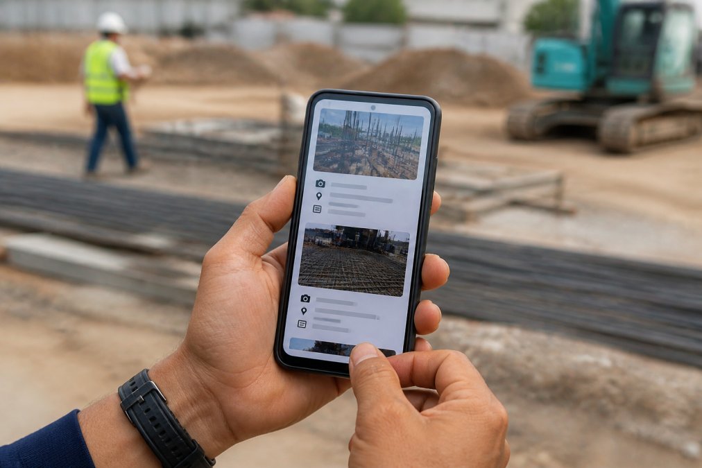
Start each site visit by creating a new session or project key. Use a naming convention that includes the site name, date, and phase of work. For example: "BuildingA_Foundation_Aug2026" or "Highway12_Drainage_Inspection_Aug2026". This ensures all photos captured during that session automatically belong together.
Photograph systematically. Develop a sequence: overview shots first (showing the entire area), then medium shots (specific zones), then close-ups (defects, details, measurements). Include a photo of any signage or identifying marker at the start of each session.
Add notes immediately, not later. Capture your observations while on site. PhotoLog’s voice note feature is faster than typing if you’re wearing gloves. Use consistent terminology so your searchability doesn’t suffer.
Tag images with custom keys or categories. PhotoLog’s session-based approach simplifies this, but manually tag each image with categories like "structural," "water_damage," or "electrical."
Verify geotagging accuracy before relying on it. GPS accuracy can vary from 5 meters to 50 meters depending on satellite visibility. For critical documentation, confirm your GPS coordinates against a known reference point.
Maintain consistent file naming and organization. Use a hierarchical folder structure: Year > Project > Site > Date > Category. For example: 2026 > ClientA > BuildingB > 2026-08-15 > Structural.
Back up data daily. Field documentation is often irreplaceable. Export your session data to cloud storage or an external drive each evening. PhotoLog exports to ZIP files containing images, metadata, and formatted reports.
Alternatives to Manual Field Data Entry: Automation Strategies
Manual data entry, typing notes from photos into spreadsheets after returning to the office, is where most field teams waste time. Automation strategies eliminate this friction by capturing structured data during field work.
Voice-to-text annotation is the fastest automation available. Speak observations into your phone instead of typing them. PhotoLog supports voice notes, which are stored alongside photos. For general observations, voice capture is faster than typing.
Template-based photo capture reduces decision-making in the field. Use a checklist of required shots for each inspection type to ensure you don’t miss critical areas.
Batch export and report generation automates the final step. PhotoLog generates formatted Field Reports directly from your captured data, eliminating manual compilation of photos and notes.
Integration with downstream systems bridges field data and office workflows. Exporting structured data from PhotoLog and importing it into your existing tools reduces duplicate data entry.
The key principle: capture data once, in its most detailed form, during field work. Everything that happens afterward should be automated or templated.
Long-Term Digital Preservation and Data Organization
Field documentation often has legal or compliance significance. A photo series from a structural inspection might be referenced years later in a dispute. This means your digitization strategy must account for long-term preservation.
File format selection determines whether your data remains accessible decades from now. JPEG is common but offers no metadata protection. TIFF format preserves higher image quality and supports embedded metadata more reliably. For long-term archival, consider PDF/A, a standardized format designed specifically for digital preservation.
Metadata preservation is critical. Every photo should carry GPS coordinates, date and time captured, camera model and settings, your annotations, and session or project identifier. PhotoLog captures most of this automatically and exports it with your images.
Folder and file naming conventions must survive organizational changes. A naming scheme like "2026_ProjectName_SiteName_Date_Category_SequenceNumber.jpg" remains meaningful even if the original project management system is retired.
Cloud backup versus local storage is a false choice; maintain both. Store working copies locally for quick access. Maintain backup copies in cloud storage for disaster recovery.
Indexing and searchability require planning. Implement a consistent tagging or categorization system from day one. PhotoLog’s session-based keys provide this structure automatically.
Data migration planning acknowledges that technology changes. Plan for periodic migration to current formats and systems to ensure long-term accessibility.
Digitizing field notes and photos creates a reliable, searchable archive that supports your team’s work today and protects you legally tomorrow. The workflow you establish now, from hardware selection through long-term storage, determines whether your field documentation becomes an asset or a liability. PhotoLog simplifies this entire process by automating the capture, organization, and reporting steps that typically consume hours of manual work per week. Start with a clear naming convention, maintain consistent metadata, and back up your data regularly.
Frequently Asked Questions
What is the best way to digitize handwritten field notes?
Capture handwritten notes with a high-resolution camera or scanner at 300 DPI minimum to ensure optical character recognition can process the text accurately. Use consistent lighting and straight angles to avoid shadows. Store images in searchable formats like PDF/A for long-term archival. For field work, typed annotations directly into your mobile field data collection app often prove faster than transcribing later.
How can I ensure my digital field records are searchable?
Apply consistent metadata tagging and file naming conventions immediately after capture. Include session keys, dates, and location identifiers in your filenames. Use EXIF data and geotagging to embed location and timestamp information automatically. Implement optical character recognition on all text-based content, then store files in searchable formats like PDF or structured databases. Cloud synchronization ensures your records remain indexed and accessible across devices, enabling quick retrieval by event key or date.
What are the benefits of using geotagged photos for site inspections?
Geotagged photos automatically record precise location and timestamp data, creating an auditable chain of custody for compliance documentation. This eliminates manual location entry and reduces errors. For environmental consultants and infrastructure managers, accurate GPS coordinates are critical for regulatory compliance and site mapping. Geotagging also enables batch processing of photos by location, simplifies organizing multiple project sites, and allows you to verify that inspections occurred at the correct coordinates before submitting official reports.
Can mobile field data collection apps work offline?
Yes, most mobile field data collection apps function offline by storing photos, notes, and metadata locally on your device. Geotagging, timestamping, and voice annotations work without cell service. Once you return to an area with connectivity, the app syncs your data to cloud storage automatically. This workflow is essential for remote field work where spotty or no cell service is common. Verify that your chosen app supports offline capture and automatic synchronization to avoid data loss in areas with poor coverage.
This article was written using GrandRanker